IMAGES TAKEN NEAR TO
Fox Holes Grove, SHEFFIELD, S36 4HN
Introduction
This page details the photographs taken nearby to Fox Holes Grove, S36 4HN by members of the Geograph project.
The Geograph project started in 2005 with the aim of publishing, organising and preserving representative images for every square kilometre of Great Britain, Ireland and the Isle of Man.

There are currently over 7.5m images from over14,400 individuals and you can help contribute to the project by visiting https://www.geograph.org.uk
Image Map (14 Images)


Getting Data...Please wait
Leaflet Map data © OpenStreetMap
Images are licensed for reuse under creativecommons.org/licenses/by-sa/2.0
Notes
- Clicking on the map will re-center to the selected point.
- The higher the marker number, the further away the image location is from the centre of the postcode.
Image Listing (14 Images Found)
Images are licensed for reuse under creativecommons.org/licenses/by-sa/2.0
Image
Details
Distance
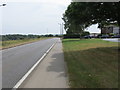
1
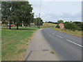
Road (A616) at Crow Edge
Looking north-westward.
Image: © Peter Wood
Taken: 6 Aug 2018
0.04 miles
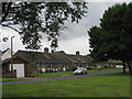
2
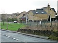
Fox Holes Grove
New houses alongside the A616 at Crow Edge.
Image: © Christine Johnstone
Taken: 10 Jan 2012
0.04 miles
6
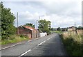
The A616 at Crow Edge, Dunford
On the left a building probably left over from a former mine. Somehow the rusty roof makes it picturesque. In the distance the hamlet of Crow Edge; suburban in character but nowhere near a town. The original development seems to be a group of council houses for mine workers, and it has an attractive green strip alongside the main road.
Image: © Humphrey Bolton
Taken: 21 Aug 2008
0.12 miles
7
Road (A616) at Crow Edge
Looking south-eastward.
Image: © Peter Wood
Taken: 6 Aug 2018
0.12 miles
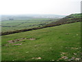
8
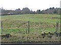
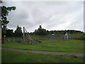
Rough grazing above Whams Road
With a wind turbine semaphoring from the disused tip behind the trees.
Image: © Christine Johnstone
Taken: 10 Jan 2012
0.16 miles
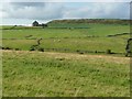
9
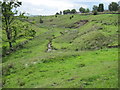
Crow Edge
On the left is the ruined Lower Whitley Farm, and in the middle distance the huge Pipe Works of Hepworth Building Products ( http://www.hepworth.co.uk ). The view is from the footpath which descends from Upper Whitley Edge.
Image: © Barry Hurst
Taken: 4 May 2006
0.18 miles
10
Lower Whitley Farm, Dunford
Seen from the A616. The hill behind the farm is Upper Whitley Edge.
Image: © Humphrey Bolton
Taken: 21 Aug 2008
0.18 miles