IMAGES TAKEN NEAR TO
Millstone Close, DRONFIELD, S18 8ZL
Introduction
This page details the photographs taken nearby to Millstone Close, S18 8ZL by members of the Geograph project.
The Geograph project started in 2005 with the aim of publishing, organising and preserving representative images for every square kilometre of Great Britain, Ireland and the Isle of Man.

There are currently over 7.5m images from over14,400 individuals and you can help contribute to the project by visiting https://www.geograph.org.uk
Image Map
Images are licensed for reuse under creativecommons.org/licenses/by-sa/2.0
Notes
- Clicking on the map will re-center to the selected point.
- The higher the marker number, the further away the image location is from the centre of the postcode.
Image Listing (13 Images Found)
Images are licensed for reuse under creativecommons.org/licenses/by-sa/2.0
Image
Details
Distance
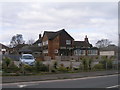
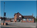
2
Talbot Arms, Stubley Lane
At the junction with Barnes Lane, Dronfield Woodhouse
Image: © Peter Barr
Taken: 20 Feb 2010
0.15 miles
3
St Andrews Church and Pentland Road Shops, Gosforth Valley
A Church strong in the ecumenical tradition with its church school nearby.
Image: © Ted Thomas
Taken: 14 Jan 2007
0.16 miles
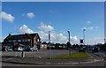
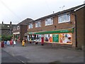
5
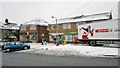
Weather like this is good for local shops
Image: © Chris Morgan
Taken: 23 Jan 2013
0.19 miles
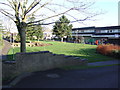
6
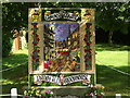
Dappled sunlight
Well Dressing on Carr Lane
Image: © Stephen Mather
Taken: 13 Jul 2008
0.20 miles
8
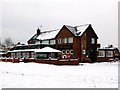
The Talbot
A large pub at the local commercial centre.
Image: © Graham Hogg
Taken: 23 Jan 2013
0.20 miles
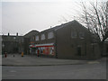
10
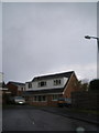
Shops on Barnes Lane, Dronfield Woodhouse
Image: © Martin Speck
Taken: 5 Aug 2009
0.21 miles