1
Old weir across River Sheaf
Below Ladies' Spring Wood holding water to be diverted down the mill race and into the mill pond for the Abbeydale Industrial Hamlet.
Image: © Chris Morgan
Taken: 20 Sep 2019
0.04 miles
2
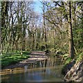
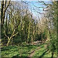
River Sheaf through Ladies Spring Wood
Image: © Chris Morgan
Taken: 11 Apr 2020
0.04 miles
3
River Sheaf in Ladies Spring Wood
Image: © Chris Morgan
Taken: 11 Apr 2020
0.05 miles
4
CrossCountry Train heads north through snowy Dore
On this day CrossCountry managed to run their services well between Edinburgh and Penzance when East Midlands struggled between London and Sheffield
Image: © Chris Morgan
Taken: 1 Dec 2010
0.05 miles
5
Abbeydale Weir
The weir on the Sheaf for the millpond at Abbeydale Industrial Hamlet.
Image: © Martin Speck
Taken: 10 May 2009
0.06 miles
6
Limb Brook above Limb Bridge
Since pre-Norman times this was a border, at one time between Mercia to the left and Northumbria to the right. Until 1934 Derbyshire and the Province of Canterbury was to the left, Yorkshire and the Province of York to the right. Now it's all part of South Yorkshire and the Province of York.
The bed of the brook is discoloured a rusty red after bog iron, or ferric hydroxide, flooded down the valley in February, colouring the River Sheaf a long way downstream with an alarming muddy orange hue.
Image: © Chris Morgan
Taken: 9 Apr 2020
0.06 miles
7
Freightliner light engine 66617 at Dore & Totley
This light engine was running early because the East Midlands Liverpool - Norwich train it should have followed along the Hope Valley was almost an hour late!
Waiting for a service on the Midland mainline to clear Dore Station Junction before heading north through Sheffield.
The section through Dore & Totley station was singled in 1985 and the remaining platform (from previous 4) shortened from the position of the signals.
Plans to redouble this section and lengthen the platform again go back to at least 2005. The Hope Valley Caapcity Improvement Scheme set out plans to do that by the end of 2018. The latest update pushed that back to 2023.
Now, who knows!
Image: © Chris Morgan
Taken: 16 Mar 2020
0.06 miles
8
Hair Union and Summer House Restaurant
Beside Dore & Totley railway station. Both currently closed during the coronavirus crisis.
Image: © Chris Morgan
Taken: 6 Apr 2020
0.07 miles
9
Peppercorn Restaurant
Image: © N Chadwick
Taken: 30 Aug 2015
0.08 miles
10
Is your journey really necessary?
From Dore & Totley station this Friday the answer was clearly - No! Reverse marketing at present. Keep off the trains.
For years users have complained that trains are too short, are far too often late, and that there's no space in the car park!
In recent weeks the trains have been longer. Now they're carrying very few passengers and are keeping far more closely to time.
We long for the days when we had overcrowded trains and no space to get parked. Will they ever return?
Coronavirus may have hastened the uptake of home working, and probably rendering many rail capacity calculations out of date.
Image: © Chris Morgan
Taken: 27 Mar 2020
0.08 miles


