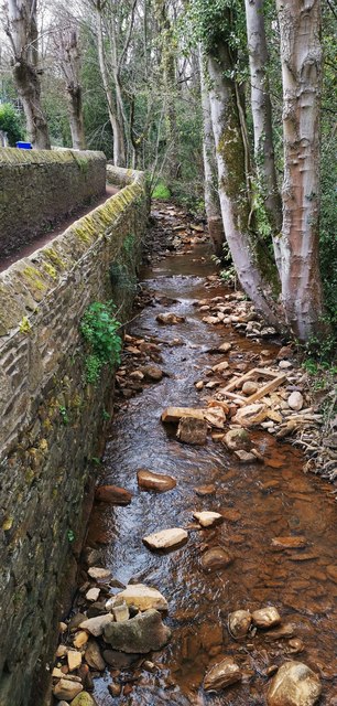
Limb Brook above Limb Bridge
Introduction
The photograph on this page of Limb Brook above Limb Bridge by Chris Morgan as part of the Geograph project.
The Geograph project started in 2005 with the aim of publishing, organising and preserving representative images for every square kilometre of Great Britain, Ireland and the Isle of Man.
There are currently over 7.5m images from over 14,400 individuals and you can help contribute to the project by visiting https://www.geograph.org.uk

Image: © Chris Morgan Taken: 9 Apr 2020
Since pre-Norman times this was a border, at one time between Mercia to the left and Northumbria to the right. Until 1934 Derbyshire and the Province of Canterbury was to the left, Yorkshire and the Province of York to the right. Now it's all part of South Yorkshire and the Province of York. The bed of the brook is discoloured a rusty red after bog iron, or ferric hydroxide, flooded down the valley in February, colouring the River Sheaf a long way downstream with an alarming muddy orange hue.

