
IMAGES TAKEN NEAR TO
Ecclesall Road, SHEFFIELD, S11 8HR
Introduction
This page details the photographs taken nearby to Ecclesall Road, S11 8HR by members of the Geograph project.
The Geograph project started in 2005 with the aim of publishing, organising and preserving representative images for every square kilometre of Great Britain, Ireland and the Isle of Man.

There are currently over 7.5m images from over14,400 individuals and you can help contribute to the project by visiting https://www.geograph.org.uk
Image Map
Images are licensed for reuse under creativecommons.org/licenses/by-sa/2.0
Notes
- Clicking on the map will re-center to the selected point.
- The higher the marker number, the further away the image location is from the centre of the postcode.
Image Listing (157 Images Found)
Images are licensed for reuse under creativecommons.org/licenses/by-sa/2.0
Image
Details
Distance
1

The Sheaf Island, Ecclesall Road
A J D Wetherspoon pub, occupying part of the site of the former Sheaf Brewery.
Image: © Stephen Craven
Taken: 12 Jul 2025
0.01 miles
2

Ward's brewery arch, Ecclesall Road
A relic of the former Ward's Sheaf Brewery, probably relocated to this site outside the present Wetherspoon pub.
Image: © Stephen Craven
Taken: 12 Jul 2025
0.01 miles
3
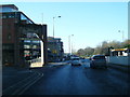
A625 at the commemorative arch to Wards Brewery
Image: © Colin Pyle
Taken: 13 Dec 2014
0.01 miles
4

Wards Brewery Gateway
A forlorn reminder of what used to be
Image: © Glyn Baker
Taken: 16 Apr 2011
0.02 miles

6
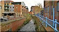
Porter Brook
The Porter Brook flows largely unseen behind high buildings and often beneath them in culverts. To the left used to be Wards Brewery, the site now redeveloped as flats.
Image: © Chris Morgan
Taken: 24 Nov 2012
0.03 miles
7

Former Sheaf Brewery
Behind a modern residential frontage is the old brewery tower, now also converted to residential use. Built for Bradley's Soho Brewery in 1837, it was taken over by S H Ward & Co. in 1876, and renamed the Sheaf Brewery, although it stands on the Porter Brook rather than the river Sheaf itself. Despite being taken over by Vaux in 1972 beer was brewed here under the Ward name until 1999.
Source: https://www.breweryhistory.com/wiki/index.php/Ward_%26_Co._Ltd
Image: © Stephen Craven
Taken: 12 Jul 2025
0.03 miles
8
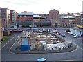
William Street
This was once the site of the Jolly Buffer public house. It has since been developed into high density housing with a chip shop below.
Image: © Martin Speck
Taken: 18 Oct 2007
0.03 miles
9
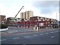
Building site on William Street
Building site on William Street as seen from Ecclesall Road.
Image: © Martin Speck
Taken: 14 Nov 2007
0.04 miles
10

Hop sculpture outside The Granary
A tribute to Ward's Sheaf brewery that formerly stood nearby.
Image: © Stephen Craven
Taken: 12 Jul 2025
0.04 miles