IMAGES TAKEN NEAR TO
Ringinglow Village, SHEFFIELD, S11 7TS

Introduction

This page details the photographs taken nearby to Ringinglow Village, S11 7TS by members of the Geograph project.

The Geograph project started in 2005 with the aim of publishing, organising and preserving representative images for every square kilometre of Great Britain, Ireland and the Isle of Man.

There are currently over 7.5m images from over14,400 individuals and you can help contribute to the project by visiting https://www.geograph.org.uk

Image Map


Images are licensed for reuse under creativecommons.org/licenses/by-sa/2.0
Notes
  • Clicking on the map will re-center to the selected point.
  • The higher the marker number, the further away the image location is from the centre of the postcode.

Image Listing (67 Images Found)

Images are licensed for reuse under creativecommons.org/licenses/by-sa/2.0
  • ...
Image
Details
Distance
1
The Norfolk Arms, Ringinglow, Sheffield
Image: © Graham Hogg Taken: 18 Jun 2010
0.01 miles
2
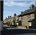
Cottages in Ringinglow
View with the edge of the former toll house on the left.
Image: © Andrew Hill Taken: 6 Sep 2012
0.01 miles
3
The tollhouse and the Norfolk Arms, Ringinglow
The tollhouse is called 'Ringinglow Roundhouse' according to the listing details, but it is actually octagonal, built c.1778. The Norfolk Arms was built much later, c.1840.
Image: © Humphrey Bolton Taken: 7 Jul 1999
0.01 miles
4
Old Toll House, Ringinglow Roundhouse
Ringinglow (Barber Field Cupola) by the UC road, in parish of Sheffield (Sheffield District), Ringinglow Roundhouse, No. 7, Ringinglow Road, S11 7PP. Grade II listed. List Entry Number: 1271045 https://historicengland.org.uk/listing/the-list/list-entry/1271045 Surveyed Milestone Society National ID: YS.SHE02
Image: © Alan Rosevear Taken: 23 Apr 2010
0.02 miles
5
The Norfolk arms in Ringinglow.
A lovely old pub.
Image: © steven ruffles Taken: 19 Aug 2018
0.02 miles
6
The Norfolk Arms at Ringinglow
Image: © David Martin Taken: 16 Feb 2016
0.02 miles
7
The Round House, Ringinglow
A former toll house constructed around 1778. Now Grade II listed.
Image: © Neil Theasby Taken: 5 Sep 2019
0.02 miles
8
Former toll house at Ringinglow
Image: © Colin Park Taken: 1 Nov 2018
0.02 miles
9
The Roundhouse at Ringinglow
A former toll house.
Image: © David Martin Taken: 16 Feb 2016
0.02 miles
10
Pub and former tollhouse, Ringinglow
The tollhouse was for travellers along Houndkirk Road, which crossed the moors ultimately en route for Chapel-en-le-Frith.
Image: © Andrew Hill Taken: 6 Sep 2012
0.02 miles
  • ...