Old Toll House, Ringinglow Roundhouse
Introduction
The photograph on this page of Old Toll House, Ringinglow Roundhouse by Alan Rosevear as part of the Geograph project.
The Geograph project started in 2005 with the aim of publishing, organising and preserving representative images for every square kilometre of Great Britain, Ireland and the Isle of Man.

There are currently over 7.5m images from over 14,400 individuals and you can help contribute to the project by visiting https://www.geograph.org.uk
Old Toll House, Ringinglow Roundhouse
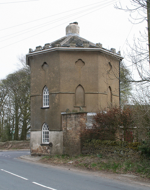
Image: © Alan Rosevear Taken: 23 Apr 2010
Ringinglow (Barber Field Cupola) by the UC road, in parish of Sheffield (Sheffield District), Ringinglow Roundhouse, No. 7, Ringinglow Road, S11 7PP. Grade II listed. List Entry Number: 1271045 https://historicengland.org.uk/listing/the-list/list-entry/1271045 Surveyed Milestone Society National ID: YS.SHE02
Images are licensed for reuse under creativecommons.org/licenses/by-sa/2.0
Image Location
Latitude
53.349566
Longitude
-1.564592