IMAGES TAKEN NEAR TO
Hatfield Road, DAGENHAM, RM9 6JT
Introduction
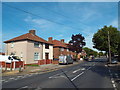
This page details the photographs taken nearby to Hatfield Road, RM9 6JT by members of the Geograph project.
The Geograph project started in 2005 with the aim of publishing, organising and preserving representative images for every square kilometre of Great Britain, Ireland and the Isle of Man.

There are currently over 7.5m images from over14,400 individuals and you can help contribute to the project by visiting https://www.geograph.org.uk
Image Map
Images are licensed for reuse under creativecommons.org/licenses/by-sa/2.0
Notes
- Clicking on the map will re-center to the selected point.
- The higher the marker number, the further away the image location is from the centre of the postcode.
Image Listing (27 Images Found)
Images are licensed for reuse under creativecommons.org/licenses/by-sa/2.0
Image
Details
Distance
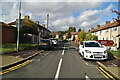
2
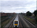
Railway to London, train to Upminster Station
As seen from the footbridge between Coleman Road and Ivyhouse Road. The two lines on the left are used by the District Lines Underground trains. The two lines on the right (one with a train on), are used by the main line on the London Tilbury and Southend Railway.
Image: © David Anstiss
Taken: 31 Mar 2013
0.05 miles
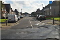
3
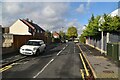
Hedgemans Way, Becontree
Hedgemans Way on the Becontree Estate.
Image: © Malc McDonald
Taken: 28 Aug 2017
0.06 miles
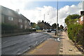
4
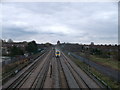
Railway to Upminster Station
As seen from the footbridge between Coleman Road and Ivyhouse Road.
The two lines on the right are used by the District Lines Underground trains heading towards Dagenham Heathway.
The two lines on the right (one with a train on), are used by the main line on the London Tilbury and Southend Railway. Heading towards Upminister Station.
Image: © David Anstiss
Taken: 31 Mar 2013
0.06 miles
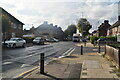
5
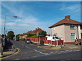
Hedgemans Road, Becontree
Hedgemans Road, on the Becontree Estate.
Image: © Malc McDonald
Taken: 28 Aug 2017
0.07 miles
10
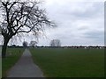
Path in Parsloes Park
This path leads from Ivyhouse Road towards Parsloes Avenue.
The park is mainly used as a recreational ground.
On the right Ivy Walk (road) can just be seen.
Image: © David Anstiss
Taken: 31 Mar 2013
0.14 miles