IMAGES TAKEN NEAR TO
Colchester Road, ROMFORD, RM3 9SF
Introduction
This page details the photographs taken nearby to Colchester Road, RM3 9SF by members of the Geograph project.
The Geograph project started in 2005 with the aim of publishing, organising and preserving representative images for every square kilometre of Great Britain, Ireland and the Isle of Man.

There are currently over 7.5m images from over14,400 individuals and you can help contribute to the project by visiting https://www.geograph.org.uk
Image Map
Images are licensed for reuse under creativecommons.org/licenses/by-sa/2.0
Notes
- Clicking on the map will re-center to the selected point.
- The higher the marker number, the further away the image location is from the centre of the postcode.
Image Listing (4 Images Found)
Images are licensed for reuse under creativecommons.org/licenses/by-sa/2.0
Image
Details
Distance
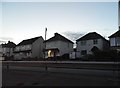
3
A12 Colchester Road, Harold Hill, Essex
Looking south from Petersfield Avenue
Image: © John Winfield
Taken: 4 Jul 2005
0.21 miles
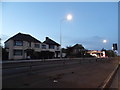
4
Harold Park Baptist Church
A service station on the A12 and the little Baptist church at the corner of Harold Court Road and Ingreway are among the few institutions around here to actually use the name ‘Harold Park’ rather than ‘Harold Court’. This modern church is on the north side of Ingreway, between the A12 and the main line out of Liverpool Street to East Anglia.
Image: © Marathon
Taken: 10 May 2017
0.21 miles