
IMAGES TAKEN NEAR TO
Cotswold Road, ROMFORD, RM3 0TR
Introduction
This page details the photographs taken nearby to Cotswold Road, RM3 0TR by members of the Geograph project.
The Geograph project started in 2005 with the aim of publishing, organising and preserving representative images for every square kilometre of Great Britain, Ireland and the Isle of Man.

There are currently over 7.5m images from over14,400 individuals and you can help contribute to the project by visiting https://www.geograph.org.uk
Image Map
Images are licensed for reuse under creativecommons.org/licenses/by-sa/2.0
Notes
- Clicking on the map will re-center to the selected point.
- The higher the marker number, the further away the image location is from the centre of the postcode.
Image Listing (24 Images Found)
Images are licensed for reuse under creativecommons.org/licenses/by-sa/2.0
Image
Details
Distance
3
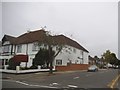
Rosslyn Avenue, Harold Wood
Abbeleigh House care home is on the left.
Image: © David Howard
Taken: 3 Sep 2017
0.09 miles
4
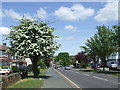
Squirrels Heath Road, Harold Wood
Blossom on the tree in the foreground is a sign that this image was taken in spring.
Image: © Malc McDonald
Taken: 25 May 2013
0.09 miles
5
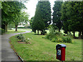
In Harold Wood Park
A path towards the north-west corner of this large park, which has playing fields and extensive semi-natural areas adjacent.
Image: © Robin Webster
Taken: 11 Jun 2011
0.17 miles
6
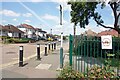
Recreation Avenue, Harold Wood
A picture taken at the entrance to Harold Wood Park, which no doubt explains the street name.
On the railngs is a home made 20mph Speed Limit sign done by kids at the primary school on the other side of the park gate.
Image: © Des Blenkinsopp
Taken: 17 Jul 2024
0.18 miles
8
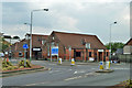
Harold Wood Neighbourhood Centre
Formerly a school.
Image: © Robin Webster
Taken: 11 Jun 2011
0.20 miles
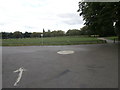
9
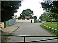
A way out of Harold Wood Park
To Recreation Avenue and Coombe Road.
Image: © Robin Webster
Taken: 11 Jun 2011
0.20 miles
10
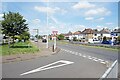
Southend Arterial Road
Southend Arterial Road, aka A127, cuts diagonally across TQ5489, a square which otherwise mostly consists of residential streets.
Image: © Des Blenkinsopp
Taken: 17 Jul 2024
0.20 miles