
IMAGES TAKEN NEAR TO
Church Road, ROMFORD, RM3 0SD
Introduction
This page details the photographs taken nearby to Church Road, RM3 0SD by members of the Geograph project.
The Geograph project started in 2005 with the aim of publishing, organising and preserving representative images for every square kilometre of Great Britain, Ireland and the Isle of Man.

There are currently over 7.5m images from over14,400 individuals and you can help contribute to the project by visiting https://www.geograph.org.uk
Image Map
Images are licensed for reuse under creativecommons.org/licenses/by-sa/2.0
Notes
- Clicking on the map will re-center to the selected point.
- The higher the marker number, the further away the image location is from the centre of the postcode.
Image Listing (24 Images Found)
Images are licensed for reuse under creativecommons.org/licenses/by-sa/2.0
Image
Details
Distance
1
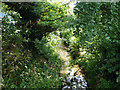
Paine's Brook
Emerging from under Church Road.
Image: © Robin Webster
Taken: 11 Jun 2011
0.05 miles
2
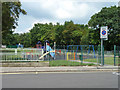
Play area, Painesbrook Open Space
Part of the bridge over Paine's Brook is on the left.
Image: © Robin Webster
Taken: 11 Jun 2011
0.06 miles
3
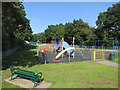
Playground in the Park
Beside the London Loop path.
Image: © Des Blenkinsopp
Taken: 8 Sep 2014
0.06 miles
4
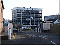
The Old Brickworks
Industrial Estate owned and managed by guess who?
http://www.thomasbates.co.uk/
Image: © Ian Paterson
Taken: 17 Dec 2009
0.06 miles
5
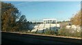
The Old Brickworks building, Bates Industrial Estate, Harold Wood, from the railway
Image: © Christopher Hilton
Taken: 18 Nov 2022
0.07 miles
6
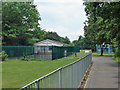
Havering Dog Training Centre
In a recreation ground by Paine's Brook - Painesbrook Open Space.
Image: © Robin Webster
Taken: 11 Jun 2011
0.07 miles
7
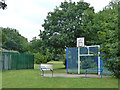
Basketball net
In a recreation ground by Paine's Brook - Painesbrook Open Space.
Image: © Robin Webster
Taken: 11 Jun 2011
0.08 miles
8
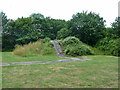
Hillock with rough tarmac ramp
In Painesbrook Open Space, this seems to be the remains of slides which, if that is what they were, disappeared from aerial views between 2003 and 2006. It looks as if there were two slides, one of which had a superstructure on top of the rise.
Image: © Robin Webster
Taken: 11 Jun 2011
0.08 miles
9
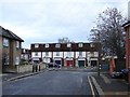
Terraced housing at Queens Park Road
The road to the right leads to the industrial estate.
Image: © Ian Paterson
Taken: 17 Dec 2009
0.09 miles
10
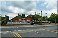
Harold Court Primary School
It is bedecked with bunting for the forthcoming school fete.
Image: © Robin Webster
Taken: 11 Jun 2011
0.10 miles