
IMAGES TAKEN NEAR TO
Ingreway, ROMFORD, RM3 0BN
Introduction
This page details the photographs taken nearby to Ingreway, RM3 0BN by members of the Geograph project.
The Geograph project started in 2005 with the aim of publishing, organising and preserving representative images for every square kilometre of Great Britain, Ireland and the Isle of Man.

There are currently over 7.5m images from over14,400 individuals and you can help contribute to the project by visiting https://www.geograph.org.uk
Image Map
Images are licensed for reuse under creativecommons.org/licenses/by-sa/2.0
Notes
- Clicking on the map will re-center to the selected point.
- The higher the marker number, the further away the image location is from the centre of the postcode.
Image Listing (13 Images Found)
Images are licensed for reuse under creativecommons.org/licenses/by-sa/2.0
Image
Details
Distance
1
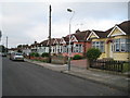
Harold Park: Ingreway
Harold Park was mainly a between the wars residential development on the eastern outskirts of Greater London on the site of farmland belonging to the former Horse Block Farm. Ingreway is home mainly to neat pairs of semi-detached bungalows like these, and runs parallel to the Ingrebourne River.
Image: © Nigel Cox
Taken: 26 Aug 2013
0.05 miles
2
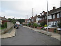
Harold Park: Maylands Way
Maylands Way is one of those roads at the very edge of Greater London. Go east from here and you are in open country. Go west and you are in the built up area as far as somewhere near Heathrow Airport. After Harold Park was mainly developed between the wars on former farmland belonging to Horse Block Farm, the houses on the right were a further post-war nibble into the countryside.
Image: © Nigel Cox
Taken: 26 Aug 2013
0.09 miles
3
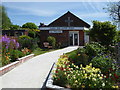
Harold Park Baptist Church
A service station on the A12 and the little Baptist church at the corner of Harold Court Road and Ingreway are among the few institutions around here to actually use the name ‘Harold Park’ rather than ‘Harold Court’. This modern church is on the north side of Ingreway, between the A12 and the main line out of Liverpool Street to East Anglia.
Image: © Marathon
Taken: 10 May 2017
0.10 miles
4

The Ingrebourne in Harold Park
Looking up stream
Image: © Glyn Baker
Taken: 15 May 2016
0.13 miles
5
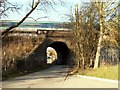
Railway bridge viewed from Harold Court Woods
The road running through the bridge is called Harold Court Road.
Image: © Robert Edwards
Taken: 11 Feb 2008
0.15 miles
6
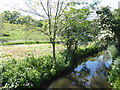
The Ingrebourne River seen from Harold Court Road
The Ingrebourne River is 27 miles long. It rises near Brentwood and flows into the Thames at Rainham. See https://en.wikipedia.org/wiki/River_Ingrebourne for more information. This view is from Harold Court Road just before the road passes under the main line between Harold Wood and Brentwood. The embankment of the railway is on the left.
Image: © Marathon
Taken: 10 May 2017
0.16 miles
7
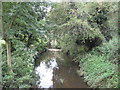
Ingrebourne River in Harold Park
What a frightening thought, 8 years and 8 months after photographing Image and I have cause to return.
The Ingrebourne is a 27 mile long tributary of the River Thames that rises near Brentwood.
Image: © Nigel Cox
Taken: 26 Aug 2013
0.16 miles
8
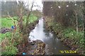
Ingrebourne River in Harold Park
Viewed looking southwestwards and downstream from the Harold Court Road bridge.
Image: © Nigel Cox
Taken: 16 Dec 2004
0.22 miles
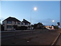
10
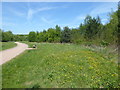
Path in Harold Court Woods
Harold Court Woods are part of Thames Chase Community Forest.
Image: © Marathon
Taken: 10 May 2017
0.22 miles