
IMAGES TAKEN NEAR TO
Hamilton Close, HORLEY, RH6 7HW
Introduction
This page details the photographs taken nearby to Hamilton Close, RH6 7HW by members of the Geograph project.
The Geograph project started in 2005 with the aim of publishing, organising and preserving representative images for every square kilometre of Great Britain, Ireland and the Isle of Man.

There are currently over 7.5m images from over14,400 individuals and you can help contribute to the project by visiting https://www.geograph.org.uk
Image Map
Images are licensed for reuse under creativecommons.org/licenses/by-sa/2.0
Notes
- Clicking on the map will re-center to the selected point.
- The higher the marker number, the further away the image location is from the centre of the postcode.
Image Listing (85 Images Found)
Images are licensed for reuse under creativecommons.org/licenses/by-sa/2.0
Image
Details
Distance
1
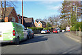
Russells Crescent, Horley
The junction with Massetts Road is just round the bend.
Image: © Robin Webster
Taken: 7 Feb 2018
0.07 miles
2
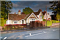
Russells Crescent
One of a pair of lodge-like buildings either side of the entrance to Russells Crescent, built presumably to add prestige to the development of the road (see Image for the other of the pair).
Image: © Ian Capper
Taken: 15 May 2012
0.08 miles
3
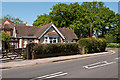
Russells Crescent
One of a pair of lodge-like buildings either side of the entrance to Russells Crescent, built presumably to add prestige to the development of the road (see Image for the other of the pair).
Image: © Ian Capper
Taken: 27 May 2012
0.08 miles
4
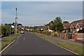
Cheyne Walk
A road of bungalows originally laid out in the 1930s but not developed until the 1950s.
Image: © Ian Capper
Taken: 5 Jul 2012
0.09 miles
5
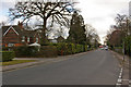
Russells Crescent
Edwardian housing in a road named after Russells Farm, once situated at the western end of the road. Despite its name, it is not a full crescent. In the distance is its junction with Victoria Road.
Image: © Ian Capper
Taken: 9 Mar 2010
0.10 miles
6

Aldeburgh House
A block of flats on a development with an East Anglian theme - accessed via Suffolk Close, there is also a Norfolk Close.
Image: © Robin Webster
Taken: 25 Mar 2010
0.10 miles
7
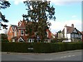
The Lawn, Horley
A guest house at the corner of Massetts Road and Ringley Avenue. Image was taken from the same spot, looking to the right.
Image: © Derek Harper
Taken: 10 Apr 2006
0.12 miles
8
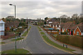
Cheyne Walk
Laid out in the 1930s as part of the Horley Gardens Estate, although not built on until the mid 1950s.
Seen here from the incline of Victoria Road as it crosses the railway at Horley Station. In the background is the North Terminal of Gatwick Airport.
Image: © Ian Capper
Taken: 9 Mar 2010
0.13 miles
9
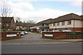
Wykeham House
A Care Home in Russells Crescent, built in 1994.
Image: © Ian Capper
Taken: 9 Mar 2010
0.14 miles
10
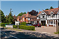
Massetts Road
An old route along the southern edge of Horley Common (now fully built over), Massetts Road itself was largely developed in the early 20th century. Now many of the large houses are Guest Houses serving nearby Gatwick Airport.
Image: © Ian Capper
Taken: 27 May 2012
0.15 miles