
IMAGES TAKEN NEAR TO
Pippbrook Gardens, DORKING, RH4 1JF
Introduction
This page details the photographs taken nearby to Pippbrook Gardens, RH4 1JF by members of the Geograph project.
The Geograph project started in 2005 with the aim of publishing, organising and preserving representative images for every square kilometre of Great Britain, Ireland and the Isle of Man.

There are currently over 7.5m images from over14,400 individuals and you can help contribute to the project by visiting https://www.geograph.org.uk
Image Map
Images are licensed for reuse under creativecommons.org/licenses/by-sa/2.0
Notes
- Clicking on the map will re-center to the selected point.
- The higher the marker number, the further away the image location is from the centre of the postcode.
Image Listing (295 Images Found)
Images are licensed for reuse under creativecommons.org/licenses/by-sa/2.0
Image
Details
Distance
1
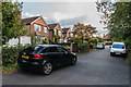
Pippbrook Gardens
1920s or early 1930s housing off London Road.
Image: © Ian Capper
Taken: 10 Oct 2016
0.00 miles
3
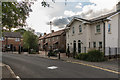
Tutts Close
A 2011 development off London Road on the site of a garage operated by R. W. Tutt & Co Ltd, now based in Curtis Road in Dorking.
The building on the far left of the photo is Rose Cottage, an early - mid 19th Century grade II listed house - see https://www.historicengland.org.uk/listing/the-list/list-entry/1028874.
Image: © Ian Capper
Taken: 10 Oct 2016
0.03 miles
4
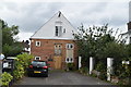
Mill House
Grade II listed. https://historicengland.org.uk/listing/the-list/list-entry/1287216
Image: © N Chadwick
Taken: 28 Aug 2019
0.03 miles
5
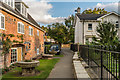
Pippbrook Mill
Former mill building, now converted to offices with residential flats in the upper floors. It originally dates from the 18th Century but the current building is a replica from 1979, after the original suffered a fire. It was refurbished in 2011 having fallen into disuse.
On the right is 1 Tutts Close, part of a 2011 development on the site of a garage operated by R. W. Tutt & Co Ltd, now based in Curtis Road in Dorking.
Image: © Ian Capper
Taken: 10 Oct 2016
0.03 miles
6
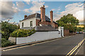
Mill House
Early 19th Century house in London Road, near the former Pippbrook Mill. Grade II listed - see https://www.historicengland.org.uk/listing/the-list/list-entry/1287216.
Image: © Ian Capper
Taken: 10 Oct 2016
0.03 miles
8
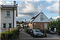
Pippbrook Mill
Former mill building, now converted to offices with residential flats in the upper floors. It originally dates from the 18th Century but the current building is a replica from 1979, after the original suffered a fire. It was refurbished in 2011 having fallen into disuse.
On the left is 1 Tutts Close, part of a 2011 development on the site of a garage operated by R. W. Tutt & Co Ltd, now based in Curtis Road in Dorking.
In the background are houses in Fairfield Drive.
Image: © Ian Capper
Taken: 10 Oct 2016
0.04 miles
9
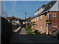
Walkway from London Road
The walkway over the Pipp Brook from London Road to Fairfield Drive.
Image: © Alan Hunt
Taken: 20 Apr 2015
0.04 miles
10
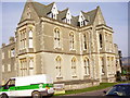
Public Library, Pippbrook House, Reigate Road, Dorking, RH4 1SH
Looking North from Mole Valley District Council Offices' grounds
Image: © Rib
Taken: 24 Jan 2006
0.04 miles