Pippbrook Mill
Introduction
The photograph on this page of Pippbrook Mill by Ian Capper as part of the Geograph project.
The Geograph project started in 2005 with the aim of publishing, organising and preserving representative images for every square kilometre of Great Britain, Ireland and the Isle of Man.

There are currently over 7.5m images from over 14,400 individuals and you can help contribute to the project by visiting https://www.geograph.org.uk
Pippbrook Mill
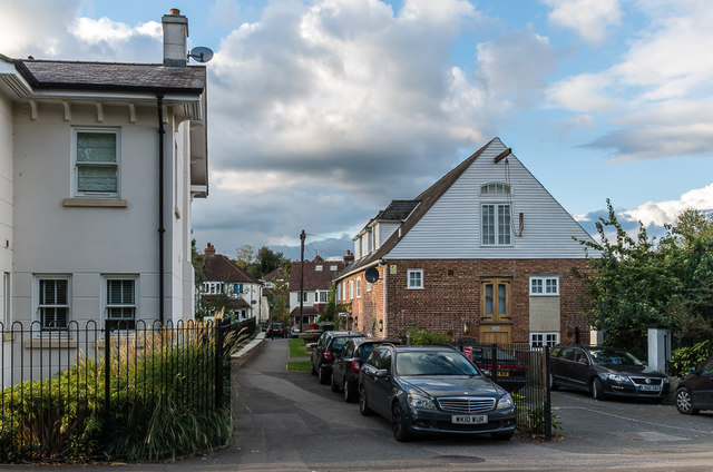
Image: © Ian Capper Taken: 10 Oct 2016
Former mill building, now converted to offices with residential flats in the upper floors. It originally dates from the 18th Century but the current building is a replica from 1979, after the original suffered a fire. It was refurbished in 2011 having fallen into disuse. On the left is 1 Tutts Close, part of a 2011 development on the site of a garage operated by R. W. Tutt & Co Ltd, now based in Curtis Road in Dorking. In the background are houses in Fairfield Drive.
Images are licensed for reuse under creativecommons.org/licenses/by-sa/2.0
Image Location
Latitude
51.236854
Longitude
-0.326748