
IMAGES TAKEN NEAR TO
High Trees Road, REIGATE, RH2 7EH
Introduction
This page details the photographs taken nearby to High Trees Road, RH2 7EH by members of the Geograph project.
The Geograph project started in 2005 with the aim of publishing, organising and preserving representative images for every square kilometre of Great Britain, Ireland and the Isle of Man.

There are currently over 7.5m images from over14,400 individuals and you can help contribute to the project by visiting https://www.geograph.org.uk
Image Map
Images are licensed for reuse under creativecommons.org/licenses/by-sa/2.0
Notes
- Clicking on the map will re-center to the selected point.
- The higher the marker number, the further away the image location is from the centre of the postcode.
Image Listing (53 Images Found)
Images are licensed for reuse under creativecommons.org/licenses/by-sa/2.0
Image
Details
Distance
1
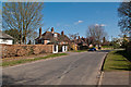
High Trees Road
A road following the High Trees ridge. It originally served as an access route to the Waterlow family's house, High Trees (see Image). Housing development started in the 1930s.
Image: © Ian Capper
Taken: 1 Apr 2012
0.05 miles
2
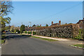
High Trees Road
Upmarket residential road along part of the Greensand ridge between Reigate and Redhill.
Image: © Ian Capper
Taken: 19 Apr 2021
0.05 miles
3
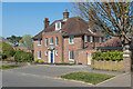
7 High Trees Road
c.1920s/30s house in High Trees Road, named Tepestede on the 1962 1:1,250 map.
Image: © Ian Capper
Taken: 19 Apr 2021
0.05 miles
4
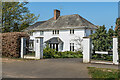
5 High Trees Road
c.1920s/30s house in High Trees Road, named The White House.
Image: © Ian Capper
Taken: 19 Apr 2021
0.07 miles
5
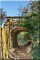
Bridge to nowhere
Ornate bridge over a footpath linking Cronks Hill Road and High Trees Road. It is owned by Dunottar School, an independent school which in 1933 moved into "High Trees", built by Walter Blanford Waterlow in 1867, the grounds of which are on the right of this photo. The footbridge is not marked on the 1871-2 1:2,500 map but is shown as an addition to the grounds of the house on the 1896 edition, linking them to empty land to the east, since developed as the houses on the south side of High Trees Road, hence the footbridge now leading to nowhere.
Image: © Ian Capper
Taken: 19 Apr 2021
0.08 miles
6
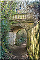
Bridge to nowhere
Ornate bridge over a footpath linking Cronks Hill Road and High Trees Road. It is owned by Dunottar School, an independent school which in 1933 moved into "High Trees", built by Walter Blanford Waterlow in 1867, the grounds of which are on the left of this photo. The footbridge is not marked on the 1871-2 1:2,500 map but is shown as an addition to the grounds of the house on the 1896 edition, linking them to empty land to the east, since developed as the houses on the south side of High Trees Road, hence the footbridge now leading to nowhere.
Image: © Ian Capper
Taken: 19 Apr 2021
0.08 miles
7
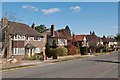
Waterlow Road
1930s housing. The road is named after the Waterlow family, who lived in nearby High Trees (see Image).
Image: © Ian Capper
Taken: 1 Apr 2012
0.09 miles
8
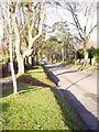
Ringley Park Avenue, Reigate
Looking North West
Image: © Rib
Taken: 21 Jan 2006
0.10 miles
9
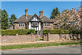
1 High Trees Road
c.1920s/30s house in High Trees Road, named Hill Craig.
Image: © Ian Capper
Taken: 19 Apr 2021
0.11 miles
10
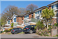
60 - 68 Cronks Hill Road
Part of a row of c.1960s/70s houses at the top of Cronks Hill Road, named Linden Heights.
Image: © Ian Capper
Taken: 24 Apr 2021
0.13 miles