Bridge to nowhere
Introduction
The photograph on this page of Bridge to nowhere by Ian Capper as part of the Geograph project.
The Geograph project started in 2005 with the aim of publishing, organising and preserving representative images for every square kilometre of Great Britain, Ireland and the Isle of Man.

There are currently over 7.5m images from over 14,400 individuals and you can help contribute to the project by visiting https://www.geograph.org.uk
Bridge to nowhere
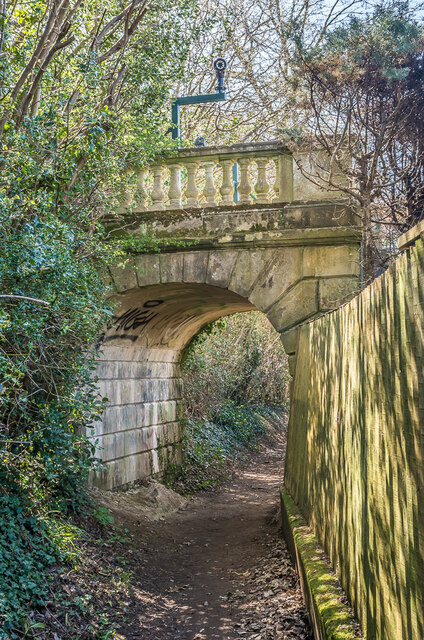
Image: © Ian Capper Taken: 19 Apr 2021
Ornate bridge over a footpath linking Cronks Hill Road and High Trees Road. It is owned by Dunottar School, an independent school which in 1933 moved into "High Trees", built by Walter Blanford Waterlow in 1867, the grounds of which are on the left of this photo. The footbridge is not marked on the 1871-2 1:2,500 map but is shown as an addition to the grounds of the house on the 1896 edition, linking them to empty land to the east, since developed as the houses on the south side of High Trees Road, hence the footbridge now leading to nowhere.
Images are licensed for reuse under creativecommons.org/licenses/by-sa/2.0
Image Location
Latitude
51.231319
Longitude
-0.185776