
IMAGES TAKEN NEAR TO
Birkheads Road, REIGATE, RH2 0AU
Introduction
This page details the photographs taken nearby to Birkheads Road, RH2 0AU by members of the Geograph project.
The Geograph project started in 2005 with the aim of publishing, organising and preserving representative images for every square kilometre of Great Britain, Ireland and the Isle of Man.

There are currently over 7.5m images from over14,400 individuals and you can help contribute to the project by visiting https://www.geograph.org.uk
Image Map
Images are licensed for reuse under creativecommons.org/licenses/by-sa/2.0
Notes
- Clicking on the map will re-center to the selected point.
- The higher the marker number, the further away the image location is from the centre of the postcode.
Image Listing (321 Images Found)
Images are licensed for reuse under creativecommons.org/licenses/by-sa/2.0
Image
Details
Distance
1
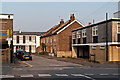
Birkheads Road
A short stub of Birkheads Road to the east of Alma Road (in the foreground). Maps suggest that the terrace of cottages date from the very end of the 19th/start of the 20th century. These have survived, whereas other buildings at the time, including what is marked on the 1896 1:2,500 map as a "lecture room", but shown on the 1963 1:2,500 map as St Mark's Church Hall, where the building on the far left of the photo now stands, have all been replaced by offices.
Image: © Ian Capper
Taken: 23 May 2012
0.01 miles
2
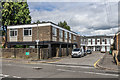
Birkheads Road
A short stub of Birkheads Road to the east of Alma Road (in the foreground). The offices on the left are on the site of what the 1896 1:2,500 map marks as a "lecture room", but shown on the 1963 1:2,500 map as St Mark's Church Hall.
Image: © Ian Capper
Taken: 28 Jun 2020
0.01 miles
3
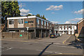
Birkheads Road
A short stub of Birkheads Road to the east of Alma Road (in the foreground). The offices on the left are on the site of what the 1896 1:2,500 map marks as a "lecture room", but shown on the 1963 1:2,500 map as St Mark's Church Hall.
Image: © Ian Capper
Taken: 3 Aug 2014
0.01 miles
4
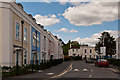
Warren Road
The building on the left, Currington House, is a development completed in 2012 on the site of a former dairy. The houses in the background are much older, dating from the turn of the 19th/20th centuries (see Image).
Image: © Ian Capper
Taken: 12 May 2012
0.03 miles
5
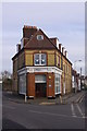
Devonshire House
Victorian building situated at the junction of Warren Road with Holmesdale Road, now used for offices.
Image: © Ian Capper
Taken: 24 Jan 2009
0.03 miles
6
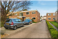
Langley Court
Low rise flats off Alma Road.
Image: © Ian Capper
Taken: 7 Apr 2020
0.03 miles
7
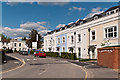
Warren Road
The building on the right, Gooding House, is a development completed in 2012 on the site of a former dairy. The houses in the background are much older, dating from the turn of the 19th/20th centuries (see Image).
Image: © Ian Capper
Taken: 12 May 2012
0.03 miles
8
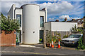
2A Warren Road
House in Warren Road on the site of former garages to the rear of 39 Holmesdale Road. It was designed by Reigate Architects to Passivhaus standards.
Image: © Ian Capper
Taken: 28 Jun 2020
0.04 miles
9
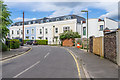
Gooding House
2012 development in Warren Road on the site of a former dairy depot. On the right is 2A Warren Road - see Image
Image: © Ian Capper
Taken: 28 Jun 2020
0.04 miles
10
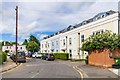
Gooding House
2012 development in Warren Road on the site of a former dairy depot. Compare the Victorian terrace in the background (see Image for closer view), which clearly influenced the design of Gooding House.
Image: © Ian Capper
Taken: 28 Jun 2020
0.04 miles