IMAGES TAKEN NEAR TO
Cansiron Lane, EAST GRINSTEAD, RH19 3SE
Introduction
This page details the photographs taken nearby to Cansiron Lane, RH19 3SE by members of the Geograph project.
The Geograph project started in 2005 with the aim of publishing, organising and preserving representative images for every square kilometre of Great Britain, Ireland and the Isle of Man.

There are currently over 7.5m images from over14,400 individuals and you can help contribute to the project by visiting https://www.geograph.org.uk
Image Map
Images are licensed for reuse under creativecommons.org/licenses/by-sa/2.0
Notes
- Clicking on the map will re-center to the selected point.
- The higher the marker number, the further away the image location is from the centre of the postcode.
Image Listing (35 Images Found)
Images are licensed for reuse under creativecommons.org/licenses/by-sa/2.0
Image
Details
Distance
1
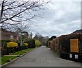
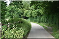
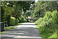
Cansiron Lane, Ashurstwood
This cul de sac is actually an offshoot of Cansiron Lane itself and is a private road though a public footpath.
Image: © Simon Carey
Taken: 7 Apr 2021
0.03 miles
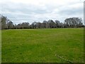
2
Parkland of Thornhill
Looking towards houses on Hammerwood Road.
Image: © Robin Webster
Taken: 21 Jan 2007
0.10 miles
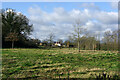
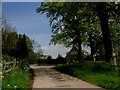
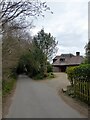
4
Nine Acres
The name of the field according to East Grinstead's 1841 tithe map that is to the north of Cansiron Lane. The hedgerow on the left marks the boundary between East and West Sussex.
Image: © Simon Carey
Taken: 7 Apr 2021
0.14 miles
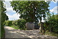
6
Gymnasium, Cansiron Lane, Ashurstwood
The name suggests a former building once used by The Abbey School which closed in the 1960s and converted into luxury flats now known as Ashurstwood Abbey.
Image: © Simon Carey
Taken: 7 Apr 2021
0.14 miles
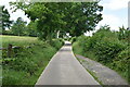
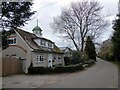
8
Thornhill Road track - approaching the Vanguard Way route
Eastward facing view along a track (Thornhill Road) about to reach a Y-junction with the Vanguard Way route.
Image: © Ed of the South
Taken: 19 May 2012
0.15 miles
10
Ridgeway House, Cansiron Lane, Ashurstwood
Postwar house located at the eastern end of the village.
Image: © Simon Carey
Taken: 7 Apr 2021
0.16 miles