IMAGES TAKEN NEAR TO
Holmans, HAYWARDS HEATH, RH17 6UQ
Introduction
This page details the photographs taken nearby to Holmans, RH17 6UQ by members of the Geograph project.
The Geograph project started in 2005 with the aim of publishing, organising and preserving representative images for every square kilometre of Great Britain, Ireland and the Isle of Man.

There are currently over 7.5m images from over14,400 individuals and you can help contribute to the project by visiting https://www.geograph.org.uk
Image Map
Images are licensed for reuse under creativecommons.org/licenses/by-sa/2.0
Notes
- Clicking on the map will re-center to the selected point.
- The higher the marker number, the further away the image location is from the centre of the postcode.
Image Listing (134 Images Found)
Images are licensed for reuse under creativecommons.org/licenses/by-sa/2.0
Image
Details
Distance
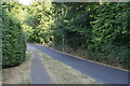
1
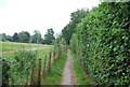
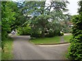
Holmans, Ardingly
A cul de sac off Street Lane that was once a field called Little Gowers according to Ardingly's 1840 tithe map. By the 1875 OS map it had become allotments and remained so until the 1970s when the small estate was built by the council.
Image: © Simon Carey
Taken: 6 Jun 2015
0.03 miles
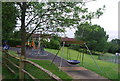
2
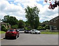
Holmans
Late 1980s housing viewed from beneath a willow tree on Street Lane.
Image: © Simon Carey
Taken: 22 Jun 2008
0.03 miles
3
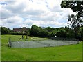
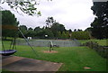
Gowers Pit, Ardingly
The local name used for this area. The depression in the ground was once an old pit that was located in the northern part of Gowers Wood. By the 1897 OS map the wood to the south had disappeared but the pit remained unit it was landscaped possibly in the 1970s or 80s and opened as a public recreational area. The houses beyond are located in Gowers Close.
Image: © Simon Carey
Taken: 6 Jun 2015
0.04 miles
7
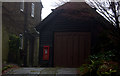
Post box in Street Lane
A personal post box ?
Image: © Robert Eva
Taken: 30 Dec 2016
0.05 miles
8
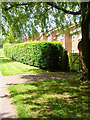
Fairfield Close, Ardingly
Small private cul de sac off Street Lane that was originally the southern portion of Gowers Wood that appears on the 1875 OS map but had disappeared by the 1897 edition. The current close was built in the 1960s and contains five properties
Image: © Simon Carey
Taken: 6 Jun 2015
0.05 miles
9
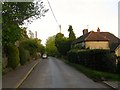
Knowle Cottages, Street Lane, Ardingly
A pair of sandstone cottages that date from the 18th century located on the lane from the village centre to the church.
Image: © Simon Carey
Taken: 9 May 2015
0.07 miles