IMAGES TAKEN NEAR TO
Buncton Lane, HAYWARDS HEATH, RH17 5RE
Introduction
This page details the photographs taken nearby to Buncton Lane, RH17 5RE by members of the Geograph project.
The Geograph project started in 2005 with the aim of publishing, organising and preserving representative images for every square kilometre of Great Britain, Ireland and the Isle of Man.

There are currently over 7.5m images from over14,400 individuals and you can help contribute to the project by visiting https://www.geograph.org.uk
Image Map
Images are licensed for reuse under creativecommons.org/licenses/by-sa/2.0
Notes
- Clicking on the map will re-center to the selected point.
- The higher the marker number, the further away the image location is from the centre of the postcode.
Image Listing (29 Images Found)
Images are licensed for reuse under creativecommons.org/licenses/by-sa/2.0
Image
Details
Distance
1
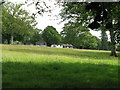
Green pastures south of Woodland Farm which can be seen in the distance
Image: © Dave Spicer
Taken: 20 Jun 2009
0.07 miles
2
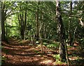
Bolney Wood
Following a section of the High Weald Landscape Trail as it heads through the wood from Bolney to Buncton Lane. Much of the wood is private and has been fenced off.
Image: © Simon Carey
Taken: 5 Oct 2014
0.10 miles
3
Nursery, Highlands Wood
Located to the south of Woodlands Farm off Buncton Lane. The open field here was made by the grubbing of part of Highlands Wood after the Second World War.
Image: © Simon Carey
Taken: 7 Sep 2014
0.13 miles
4
Waymarker at sharp bend on Buncton Lane
Image: © Dave Spicer
Taken: 20 Jun 2009
0.15 miles
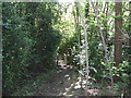
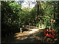
5
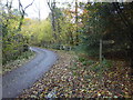
Footpath leaves Buncton Lane by sharp bend
See also http://www.geograph.org.uk/photo/1364628 from 2009.
Image: © Shazz
Taken: 18 Nov 2016
0.15 miles
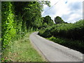
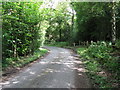
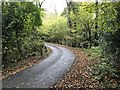
7
Buncton Lane
Narrow country lane linking Bolney Road, the A272, in the south, to Broxmead Lane in the north. This section runs past Highlands Wood on the left. A continuation of Stairbridge Lane, Pookbourne Lane and Langton Lane therefore in all probability a very old drove road connecting the estate around the foot of the South Downs and the woodland pastures of the High Weald.
Image: © Simon Carey
Taken: 7 Sep 2014
0.15 miles
8
Buncton Lane
On Buncton Lane near to Pickwell.
Image: © Chris Thomas-Atkin
Taken: 28 Oct 2018
0.15 miles
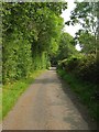
9
Buncton Lane
A view of the sharp corner north of Pickwells on this narrow single track country lane that runs between the A272 and Broxmead Lane.
Image: © Simon Carey
Taken: 5 Oct 2014
0.15 miles