IMAGES TAKEN NEAR TO
Jeremys Lane, HAYWARDS HEATH, RH17 5QE
Introduction
This page details the photographs taken nearby to Jeremys Lane, RH17 5QE by members of the Geograph project.
The Geograph project started in 2005 with the aim of publishing, organising and preserving representative images for every square kilometre of Great Britain, Ireland and the Isle of Man.

There are currently over 7.5m images from over14,400 individuals and you can help contribute to the project by visiting https://www.geograph.org.uk
Image Map
Images are licensed for reuse under creativecommons.org/licenses/by-sa/2.0
Notes
- Clicking on the map will re-center to the selected point.
- The higher the marker number, the further away the image location is from the centre of the postcode.
Image Listing (22 Images Found)
Images are licensed for reuse under creativecommons.org/licenses/by-sa/2.0
Image
Details
Distance
1
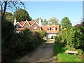
Daizes Cottage, Jeremy's Lane
A cottage built sometime in the mid 19th century and located to the west of Image and possibly part of the old Wykehurst Brickworks which once lay to the north.
Image: © Simon Carey
Taken: 19 Sep 2014
0.01 miles
2
Firdene, Jeremy's Lane
Built on the ridge containing the lane with fine views of Wykehurst Park and the countryside south to the Downs.
Image: © Simon Carey
Taken: 19 Sep 2014
0.03 miles
3
Kiln Cottage, Jeremy's Lane
Built in the 19th century a reminder that the land behind was once part of Wykehurst Brickworks up to at least the First World War. Its neighbour to the west is Image
Image: © Simon Carey
Taken: 19 Sep 2014
0.04 miles
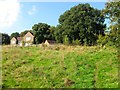
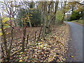
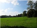
4
Long Field
The name of the field according to Bolney's 1842 tithe map that lies on a slope heading south from Jeremy's Lane with Image at the top of the slope to the left. The clump of trees in the middle mark the site of a pond possibly an old quarry or pit.
Image: © Simon Carey
Taken: 19 Sep 2014
0.06 miles
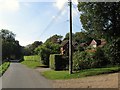
5
South Lodge, Jeremy's Lane
Dating from 1835 and possibly something to do with a former distillery which was once located next door.
Image: © Simon Carey
Taken: 25 Sep 2014
0.08 miles
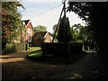
7
Footpath on drive going north from Jeremy's Lane
Image: © Shazz
Taken: 23 Nov 2016
0.11 miles
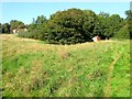
8
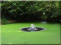
Pond, Nut Hedges, Jeremy's lane
The pond predates the building and with it located next to the road was perhaps originally a pit quarried for either sandstone or marl.
Image: © Simon Carey
Taken: 25 Sep 2014
0.12 miles
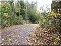
9
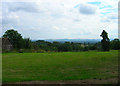
Wykehurst Park
View from the northern end at Jeremy's Lane. The High Weald banks and heads into the Low Weald from this point with superb views of the South Downs in the distance.
Image: © Simon Carey
Taken: 26 Aug 2006
0.14 miles
10
Wapses Croft/South Field
The name of the fields according to Bolney's 1842 tithe map that have been merged to form a larger unit and since the late 19th century have been part of Wykehurst Park. To the north beyond the trees is Jeremy's Lane.
Image: © Simon Carey
Taken: 19 Sep 2014
0.15 miles