
IMAGES TAKEN NEAR TO
Bishopstone Lane, HAYWARDS HEATH, RH17 5AR
Introduction
This page details the photographs taken nearby to Bishopstone Lane, RH17 5AR by members of the Geograph project.
The Geograph project started in 2005 with the aim of publishing, organising and preserving representative images for every square kilometre of Great Britain, Ireland and the Isle of Man.

There are currently over 7.5m images from over14,400 individuals and you can help contribute to the project by visiting https://www.geograph.org.uk
Image Map
Images are licensed for reuse under creativecommons.org/licenses/by-sa/2.0
Notes
- Clicking on the map will re-center to the selected point.
- The higher the marker number, the further away the image location is from the centre of the postcode.
Image Listing (18 Images Found)
Images are licensed for reuse under creativecommons.org/licenses/by-sa/2.0
Image
Details
Distance
1
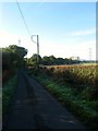
Bishopstone Lane
An old droveway that runs from Goddard's Green to the A272 continuing north of that road as Pickwell's Lane. The field beyond the hedge to the right is Image
Image: © Simon Carey
Taken: 5 Oct 2014
0.03 miles
2
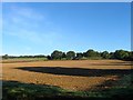
Main Meadow/Rainbow Field
The name of the fields according to Cuckfield's 1842 tithe map that have been merged to form a larger unit. Main Meadow was on the western side whilst Rainbow Field was to the east following the curve of Bishopstone Lane which is probably where it got its name. To the south is Image
Image: © Simon Carey
Taken: 5 Oct 2014
0.06 miles
3
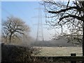
Pick Pond Eight Acres
The name of the field according to Hurtspierpoint's 1842 tithe map. This is the northern part of the field with much of the southern area now containing Amberly Farm.
Image: © Simon Carey
Taken: 30 Dec 2014
0.08 miles
4

Pylon near the Cuckfield Road
The pylon carries the electricity cables from the Sub Station at Twineham.
Image: © Chris Thomas-Atkin
Taken: 5 Nov 2017
0.16 miles
5

Stew Field
The name of the field according to Cuckfield's 1843 tithe map that lies to the west of Image and east of Bishopstone Lane. Part of the field now contains Marigold Farm.
Image: © Simon Carey
Taken: 30 Dec 2014
0.16 miles
6
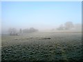
Spring Mead/Sandpit Field
The name of the fields according to Cuckfield's 1843 tithe map separated by an embankment that runs across to the right. Spring Mead was to the left of it whilst Sandpit Field was to the right. To the south is Image
Image: © Simon Carey
Taken: 30 Dec 2014
0.17 miles
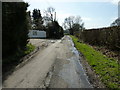
8

Pylon in the Mist, Bishopstone Lane
Too many fields to put into a title but in the foreground are Image, south of the boundary containing a few bushes astride a track is Image with Image south of the pylon. The hedge on the left marks the course of Bishopstone Lane.
Image: © Simon Carey
Taken: 30 Dec 2014
0.17 miles
9
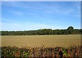
Hovel Field/Gate field
The name of the fields according to Cuckfield's 1842 tithe map that have been merged together along with Image to the south to form a larger unit. Gate Field was in the foreground adjacent to Bishopstone lane whilst Hovel Field was at the far eastern end. To the north of the current field is Image
Image: © Simon Carey
Taken: 5 Oct 2014
0.18 miles
10

Electricity Pylon, Bishopstone Lane
Visible when closer unlike the next one to the west which can just be made out through the mist.
Image: © Simon Carey
Taken: 30 Dec 2014
0.18 miles