
IMAGES TAKEN NEAR TO
Highbank, HAYWARDS HEATH, RH16 4TU
Introduction
This page details the photographs taken nearby to Highbank, RH16 4TU by members of the Geograph project.
The Geograph project started in 2005 with the aim of publishing, organising and preserving representative images for every square kilometre of Great Britain, Ireland and the Isle of Man.

There are currently over 7.5m images from over14,400 individuals and you can help contribute to the project by visiting https://www.geograph.org.uk
Image Map
Images are licensed for reuse under creativecommons.org/licenses/by-sa/2.0
Notes
- Clicking on the map will re-center to the selected point.
- The higher the marker number, the further away the image location is from the centre of the postcode.
Image Listing (35 Images Found)
Images are licensed for reuse under creativecommons.org/licenses/by-sa/2.0
Image
Details
Distance
1
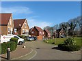
Kingfisher Drive, Bolnore Village
A cul de sac off Roundway that is bounded by the railway to the east and the old course of Rocky Lane to the south. Shaped in an arc the houses overlook a small playground.
Image: © Simon Carey
Taken: 7 Mar 2015
0.03 miles
2
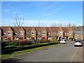
Roundway, Bolnore Village
The road heads south from Highbank allowing access to Kingfisher Drive.
Image: © Simon Carey
Taken: 7 Mar 2015
0.05 miles
3
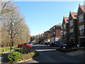
Brooklands, Bolnore Village
A cul de sac off Lower Village Street which is located opposite Image and is separated by a small stream.
Image: © Simon Carey
Taken: 7 Mar 2015
0.05 miles
4
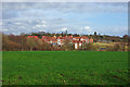
Bolnore - new housing development
The most southern cluster of houses and flats of this new development.
Image: © Robin Webster
Taken: 26 Mar 2010
0.06 miles
5
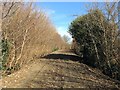
Old Course of Rocky Lane
The old narrow section that ran south westwards from Image has now been removed and is supposed to be developed into pedestrian and cycle access to the southern end of Bolnore Village.
Image: © Simon Carey
Taken: 7 Mar 2015
0.07 miles
6
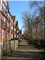
Juniper Court, Bolnore Village
The southern part of the housing which overlooks a small stream beyond which is Image
Image: © Simon Carey
Taken: 7 Mar 2015
0.07 miles
7
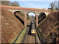
High Bridge
Viewed from Image and as such one not possible until the latter was opened in the autumn of 2014. Built at the time of the line's construction to carry Rocky Lane over the railway it has now been made redundant. Its closeness to the former St Francis Hospital meant for many decades it was a popular suicide spot resulting in the parapet being raised initially by extra layers of brickwork and later on by high fencing which has since been removed. The road sign next to the now truncated section of Rocky Lane says there is access to Bolnore's lower village but there was none on this day though I believe this will be the case in the future. Just visible in the distance beyond the Thameslink train heading south to Brighton is Ashenground Bridge.
Image: © Simon Carey
Taken: 7 Mar 2015
0.08 miles
8
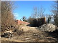
High Bridge, Rocky Lane
A view from the western end of the former course of Rocky Lane shows how narrow the bridge was for motor traffic. See also Image
Image: © Simon Carey
Taken: 7 Mar 2015
0.08 miles
9
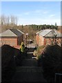
Steps to Brooklands, Bolnore Village
A feature of the estate is the large number of paths that link various roads with this one heading down to Brooklands from Highbank. Eleven Acre Wood can be seen in the distance.
Image: © Simon Carey
Taken: 7 Mar 2015
0.09 miles
10
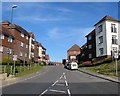
Highbank, Bolnore Village
Viewed from the new roundabout on Rocky Lane and the only access point for houses in Roundway and Kingfisher Drive. This part of the Bolnore development has no vehicle connection with the rest.
Image: © Simon Carey
Taken: 7 Mar 2015
0.10 miles