High Bridge
Introduction
The photograph on this page of High Bridge by Simon Carey as part of the Geograph project.
The Geograph project started in 2005 with the aim of publishing, organising and preserving representative images for every square kilometre of Great Britain, Ireland and the Isle of Man.

There are currently over 7.5m images from over 14,400 individuals and you can help contribute to the project by visiting https://www.geograph.org.uk
High Bridge
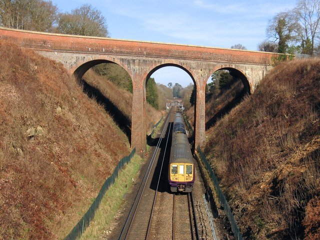
Image: © Simon Carey Taken: 7 Mar 2015
Viewed from Image and as such one not possible until the latter was opened in the autumn of 2014. Built at the time of the line's construction to carry Rocky Lane over the railway it has now been made redundant. Its closeness to the former St Francis Hospital meant for many decades it was a popular suicide spot resulting in the parapet being raised initially by extra layers of brickwork and later on by high fencing which has since been removed. The road sign next to the now truncated section of Rocky Lane says there is access to Bolnore's lower village but there was none on this day though I believe this will be the case in the future. Just visible in the distance beyond the Thameslink train heading south to Brighton is Ashenground Bridge.
Images are licensed for reuse under creativecommons.org/licenses/by-sa/2.0
Image Location
Latitude
50.985748
Longitude
-0.112657