IMAGES TAKEN NEAR TO
Isaacs Lane, HAYWARDS HEATH, RH16 4RZ
Introduction
This page details the photographs taken nearby to Isaacs Lane, RH16 4RZ by members of the Geograph project.
The Geograph project started in 2005 with the aim of publishing, organising and preserving representative images for every square kilometre of Great Britain, Ireland and the Isle of Man.

There are currently over 7.5m images from over14,400 individuals and you can help contribute to the project by visiting https://www.geograph.org.uk
Image Map
Images are licensed for reuse under creativecommons.org/licenses/by-sa/2.0
Notes
- Clicking on the map will re-center to the selected point.
- The higher the marker number, the further away the image location is from the centre of the postcode.
Image Listing (13 Images Found)
Images are licensed for reuse under creativecommons.org/licenses/by-sa/2.0
Image
Details
Distance
1
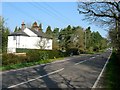
Heasewood Cottages, Isaac's Lane
Dating from the earliest 20th century and originally built in a detached portion of Clayton parish that surrounded Heasewood Farm.
Image: © Simon Carey
Taken: 9 Apr 2015
0.00 miles
2
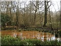
Wabblegate Wood
On the eastern side of Isaac's Lane in what was formerly Keymer parish
Image: © Simon Carey
Taken: 9 Apr 2015
0.05 miles
3
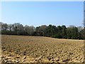
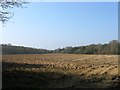
Field Number Eight
The number of the field according to Clayton's 1838 tithe map that was not given a nam on that survey. Prongers Wood is beyond.
Image: © Simon Carey
Taken: 9 Apr 2015
0.08 miles
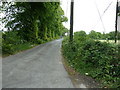
4
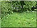
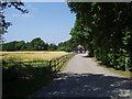
Stile with little use
On the other side of the stile is the busy A273 Burgess Hill to Haywards Heath road. The nearest path exit off the A273 is about 3/4 kilometre in either direction. Wabblegate Wood is on the left.
Image: © Dave Spicer
Taken: 15 May 2011
0.09 miles
5
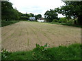
Lower Gratton/Little Hilly Field/Carthouse Field
The name of the fields according to Clayton's 1838 tithe map that have been merged to form a larger unit. Lower Gratton was located in the south west corner, Little Hilly Field in south east corner and cart house field occupying much of the northern portion
Image: © Simon Carey
Taken: 9 Apr 2015
0.09 miles
6
Heasewood Farm
The former farm buildings are now used as offices
Image: © Nigel Freeman
Taken: 12 Jul 2005
0.12 miles
7
The Old Barn, Heasewood Farm
Former farm outbuilding now converted into offices.
Image: © Simon Carey
Taken: 9 Apr 2015
0.13 miles
10
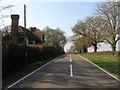
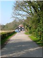
Keeper's Cottage, Isaac's Lane
On the former Keymer side of the A273.
Image: © Simon Carey
Taken: 9 Apr 2015
0.20 miles