
IMAGES TAKEN NEAR TO
Edward Road, HAYWARDS HEATH, RH16 4QJ
Introduction
This page details the photographs taken nearby to Edward Road, RH16 4QJ by members of the Geograph project.
The Geograph project started in 2005 with the aim of publishing, organising and preserving representative images for every square kilometre of Great Britain, Ireland and the Isle of Man.

There are currently over 7.5m images from over14,400 individuals and you can help contribute to the project by visiting https://www.geograph.org.uk
Image Map
Images are licensed for reuse under creativecommons.org/licenses/by-sa/2.0
Notes
- Clicking on the map will re-center to the selected point.
- The higher the marker number, the further away the image location is from the centre of the postcode.
Image Listing (52 Images Found)
Images are licensed for reuse under creativecommons.org/licenses/by-sa/2.0
Image
Details
Distance
1
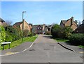
Windsor Close, Haywards Heath
A cul de sac off Edward Road that was built in the 1990s on the site of the former back gardens of houses fronting Wivelsfield Road.
Image: © Simon Carey
Taken: 7 Apr 2015
0.02 miles
2
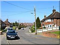
Edward Road, Haywards Heath
Developed in the late 1930s on the site of a former nursery with this section built first, and now a cul de sac, originally forming a junction with Wivelsfield Road. That was blocked off by the 1950s and access is provided to the same road a little further to the north. This part of Haywards Heath was originally part of the parish of Keymer.
Image: © Simon Carey
Taken: 7 Apr 2015
0.03 miles
3
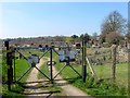
Vale Road Allotments, Haywards Heath
Originally a field that was made over to the town in 1945 for allotments. Part of the northern end was lost to the development of Vale Road in the 1950s and the threat of further development led to the allotments to become self governing in 1985
Image: © Simon Carey
Taken: 7 Apr 2015
0.07 miles
4
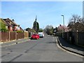
Edward Road, Haywards Heath
This section of the road heads west from Wivelsfield road where it splits into two more sections, one heading north to Vale Road and the other heading south to a dead end, though that originally also formed a junction with Wivelsfield Road but was closed off in the 1950s. This part had a few houses on it by 1947 but development was not completed until the 1960s.
Image: © Simon Carey
Taken: 7 Apr 2015
0.09 miles
5
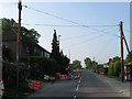
Roadworks, Wivelsfield Road
A three way temporary traffic light has been installed on the B2112 for the duration of the construction of Image The cottages on the left were built in 1863 in anticipation of the workforce needed at the recently constructed Sussex County Asylum.
The road once formed the boundary between Wivelsfield parish on the left and Keymer parish to the right with both areas transferred to Haywards Heath in 1934.
Image: © Simon Carey
Taken: 30 Apr 2011
0.10 miles
6
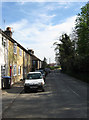
Colwell Road
See Image for a history. The cottages on the left were built during the 1860s with locally quarried sandstone. This part of the road is being turned into a cul-de-sac due to the construction of the Haywards Heath relief road.
This area of Haywards Heath was once part of Wivelsfield parish until boundary changes in 1934.
Image: © Simon Carey
Taken: 10 Apr 2011
0.11 miles
7
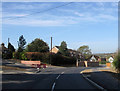
New Entrance, Colwell Road
There has always been an access road here but it has now been widened as the old entrance to Colwell Road will be blocked up due to the construction of a roundabout for the forthcoming Haywards Heath relief road. See Image
This area of Haywards Heath was once part of the parish of Wivelsfield until borders were redrawn in 1934.
Image: © Simon Carey
Taken: 10 Apr 2011
0.11 miles
8
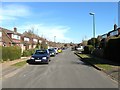
Vale Road, Haywards Heath
A residential road that runs from Ashenground Road to Bolding Way and was developed in sections starting from the late 1940s with the easterly end in view and completed by the early 1960s.
Image: © Simon Carey
Taken: 7 Mar 2015
0.11 miles
9
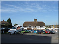
Big Pennies House
Built in the early 17th century facing onto the common known as Haywards Heath that has now been engulfed by the town that grew on it. The house has now become offices for the neighbouring Dinnages Garage. Viewed from Wivelsfield Road.
Image: © Simon Carey
Taken: 10 Apr 2011
0.12 miles
10
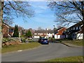
Sandy Vale, Haywards Heath
This section of the residential road was added in the 1980s and is located at the eastern end of the original 1960s development.
Image: © Simon Carey
Taken: 7 Mar 2015
0.13 miles