
IMAGES TAKEN NEAR TO
Victoria Road, HAYWARDS HEATH, RH16 3LY
Introduction
This page details the photographs taken nearby to Victoria Road, RH16 3LY by members of the Geograph project.
The Geograph project started in 2005 with the aim of publishing, organising and preserving representative images for every square kilometre of Great Britain, Ireland and the Isle of Man.

There are currently over 7.5m images from over14,400 individuals and you can help contribute to the project by visiting https://www.geograph.org.uk
Image Map
Images are licensed for reuse under creativecommons.org/licenses/by-sa/2.0
Notes
- Clicking on the map will re-center to the selected point.
- The higher the marker number, the further away the image location is from the centre of the postcode.
Image Listing (51 Images Found)
Images are licensed for reuse under creativecommons.org/licenses/by-sa/2.0
Image
Details
Distance
1
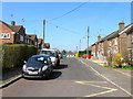
Victoria Road, Haywards Heath
A residential road that runs east from Eastern Road before coming to a dead end. Originally part of Petlands Wood that was largely grubbed before the First World War but wasn't developed until after with the exception of the houses on the right which were built around 1910 and for a while were served by a track. Those to the left were built in the 1960s on the site of a former kitchen that served the pupils of nearby St Wilfrid's School.
Image: © Simon Carey
Taken: 7 Apr 2015
0.05 miles
2
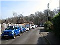
Oakdale Road, Haywards Heath
A cul de sac off Dellney Avenue that was once part of a field Barn Mead according to Cuckfield's 1843 tithe map and was developed in the 1920s.
Image: © Simon Carey
Taken: 7 Apr 2015
0.07 miles
3
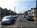
Dellney Avenue, Haywards Heath
A residential road that runs from Farnklynn's Road to Victoria Road that was originally a field called Barn Mead belonging to nearby Petlands Farm. By 1910 it had become a brick field to the north and allotments to the south prior to its development during the 1920s. However, the southern part on the site of the old farm was not developed until the 1960s whilst its northern connection with Victoria Road was not added until the 1950s.
Image: © Simon Carey
Taken: 7 Apr 2015
0.08 miles
4
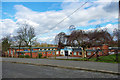
St Wilfred's CofE Primary School
In Eastern Road, Haywards Heath.
Image: © Robin Webster
Taken: 14 Mar 2010
0.08 miles
5
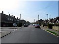
Eastern Road, Haywards Heath
A residential road connecting North Road to Franklynn Road that was laid out around 1910 and developed after the First World War, particularly the southern end, the northern part gradually being infilled after the Second World War. All the road was once part of Petlands Wood.
Image: © Simon Carey
Taken: 7 Apr 2015
0.08 miles
6
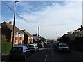
Dellney Avenue
Residential road linking Franklynn Road with Victoria Road. The foreground was originally the site of Petlands Farm which was swallowed by the development of Haywards Heath just after the First World War. The different style of houses on the left are due to the differing development, those further down were constructed before the Second World War, those immediately to the left were built after.
Image: © Simon Carey
Taken: 10 Apr 2011
0.09 miles
7
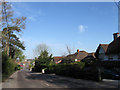
Franklynn Road
The A272 heading towards the centre of Haywards Heath. The road predates the construction of the town originally crossing a large common that was barren heathland. Until 1934 it was also the parish boundary between Wivelsfield on the left and Cuckfield to the right. At present it is very congested during the rush hour something that should be alleviated by the completion of the relief road sometime around 2015.
This area of Haywards Heath was once part of Wivelsfield parish.
Image: © Simon Carey
Taken: 10 Apr 2011
0.14 miles
8
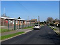
Army Cadets Training Centre, Eastern Road, Haywards Heath
Built in the mid 1960s to replace the old drill hall that was located at the cattle market. Beyond is Image
Image: © Simon Carey
Taken: 7 Apr 2015
0.14 miles
9
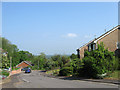
Woodridge Close
In Wivelsfield's 1843 tithe map this was a field called Great Field which belonged to nearby Franklands Farm until after the First World War when the latter was knocked down and the field sold off in plots one of which was used to build a house called Woodridge which survived into the 1980s before that too was demolished in order to build the current cul-de-sac which runs off Frankton Avenue.
This part of Haywards Heath was part of the parish of Wivelsfield until transferred in 1934.
Image: © Simon Carey
Taken: 30 Apr 2011
0.15 miles
10
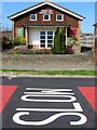
Franklynn Gospel Hall, Eastern Road, Haywards Heath
Built sometime in the 1960s for the Open Brethren and located to the immediate north of Image
Image: © Simon Carey
Taken: 7 Apr 2015
0.16 miles