
IMAGES TAKEN NEAR TO
Barnmead, HAYWARDS HEATH, RH16 1XB
Introduction
This page details the photographs taken nearby to Barnmead, RH16 1XB by members of the Geograph project.
The Geograph project started in 2005 with the aim of publishing, organising and preserving representative images for every square kilometre of Great Britain, Ireland and the Isle of Man.

There are currently over 7.5m images from over14,400 individuals and you can help contribute to the project by visiting https://www.geograph.org.uk
Image Map
Images are licensed for reuse under creativecommons.org/licenses/by-sa/2.0
Notes
- Clicking on the map will re-center to the selected point.
- The higher the marker number, the further away the image location is from the centre of the postcode.
Image Listing (42 Images Found)
Images are licensed for reuse under creativecommons.org/licenses/by-sa/2.0
Image
Details
Distance
1
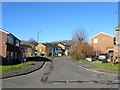
Barnmead (1), Haywards Heath
A residential estate built in the mid 1960s with the northern part built over three former fields called Barn Mead, Middle Barn Mead and Upper Barn Mead, according to Cuckfield's 1843 tithe map, and the southern section occupying the former mill ponds of Bridger's Mill, see Image
Image: © Simon Carey
Taken: 17 Feb 2015
0.02 miles
2
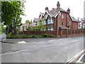
House on junction of Barnmead and Balcombe Road
Image: © Shazz
Taken: 20 May 2016
0.05 miles
3
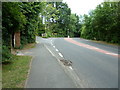
Old Wickham Lane junction with Balcombe Road
Image: © Dave Spicer
Taken: 10 Jul 2011
0.07 miles
4
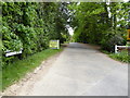
Looking into Old Wickham Lane
This is a public footpath.
Another view of the junction with Balcombe Road is at http://www.geograph.org.uk/photo/2507507.
Image: © Shazz
Taken: 20 May 2016
0.07 miles
5
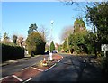
Balcombe Road, Haywards Heath
A busy C road that links haywards heath to Balcombe and predates the town for many centuries it formed part of the parish boundary between Cuckfield and Lindfield. Some police tape around the lamp post suggests a motoring accident has occurred here recently whilst on the right is the entrance to Old Wickham Lane.
Image: © Simon Carey
Taken: 17 Feb 2015
0.08 miles
7
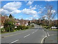
Penland Road, Haywards Heath
Running between Blacombe Road to the north and Blunts Wood Road to the south the road along with much of the adjacent housing was developed in the 1960s on land formerly belonging to Harlands Farm. The dip would have once contained a small stream which fed the former millponds of nearby Bridger's Mill.
Image: © Simon Carey
Taken: 31 Mar 2015
0.10 miles
8
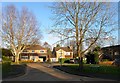
Sugworth Close, Haywards Heath
Small cul de sac off Penland Road that was built with the estate in the 1960s.
Image: © Simon Carey
Taken: 24 Jan 2015
0.11 miles
9
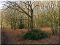
Sugworths Twelve Acres
The name of the field according to Cuckfield's 1843 tithe map of which this wooded area located in the south west corner north of Image is the only part that has not been developed. The rest of the field now lies under Penland Road, Barn Mead and Sugworth Close all of which was built during the late 1950s/early 1960s and are now part of Haywards Heath.
Image: © Simon Carey
Taken: 24 Jan 2015
0.11 miles
10
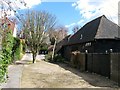
The Barn, Blacombe Road, Haywards Heath
Dating back to the 15th century and converted into a residence in the early part of the 1980s, a plaque on the wall denotes an award for the conversion and is dated 1984. It previously belonged to Image which lies to the south.
Image: © Simon Carey
Taken: 31 Mar 2015
0.12 miles