IMAGES TAKEN NEAR TO
Bridge Road, HAYWARDS HEATH, RH16 1UA
Introduction
This page details the photographs taken nearby to Bridge Road, RH16 1UA by members of the Geograph project.
The Geograph project started in 2005 with the aim of publishing, organising and preserving representative images for every square kilometre of Great Britain, Ireland and the Isle of Man.

There are currently over 7.5m images from over14,400 individuals and you can help contribute to the project by visiting https://www.geograph.org.uk
Image Map
Images are licensed for reuse under creativecommons.org/licenses/by-sa/2.0
Notes
- Clicking on the map will re-center to the selected point.
- The higher the marker number, the further away the image location is from the centre of the postcode.
Image Listing (45 Images Found)
Images are licensed for reuse under creativecommons.org/licenses/by-sa/2.0
Image
Details
Distance
1
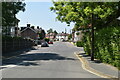
Gordon Road, Haywards Heath
The road was laid out in the first decade of the 20th century and forms a rectangle with Queens Road to the south. As can be seen by the variety of styles development was piecemeal. According to Cuckfield's 1843 tithe map this was once Five Acre Field.
Image: © Simon Carey
Taken: 1 Feb 2015
0.06 miles
2
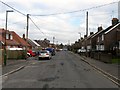
Summerhill Close, Haywards Heath
A private cul de sac off Gander Hill built between the wars.
Image: © Simon Carey
Taken: 18 Jul 2015
0.10 miles
3
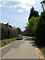
College Road, Haywards Heath
Once part of the medieval route linking Cuckfield to Lindfield the road currently runs between Mill Green Road and Smallsgreen Cross, a crossroads that also contains Summerhill Lane, Portsmouth Lane and Sunte Avenue. The houses on the right were built in the 1890s.
Image: © Simon Carey
Taken: 31 Mar 2015
0.10 miles
4
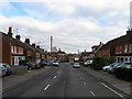
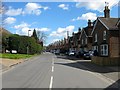
Queens Road, Haywards Heath
Built along with Image and Image in the first decade of the 20th century and running between Commercial Square and the junction of the B2028 and B2112 to the east.
Image: © Simon Carey
Taken: 1 Feb 2015
0.11 miles
5
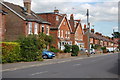
Queens Road
Taken from its junction with Church Avenue.
Image: © Trevor Harris
Taken: 18 Sep 2010
0.12 miles
7
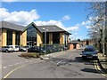
Mill Green Business Park, Haywards Heath
Once a small field to the immediate north of Scrase Stream known as Mill Legs according to Lindfield's 1845 tithe map. By the 1897 OS map it had become a brick field which had been excavated into a fish pond with a boathouse by the following 1910 edition. By the Second World War the pond had shrunk with the rest of the field now just rough ground which it remained until the 1960s when it became a depot. It was converted into the current business park some time in the last decade.
Image: © Simon Carey
Taken: 31 Mar 2015
0.14 miles
8
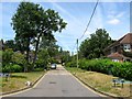
Sunte Close, Haywards Heath
A private cul de sac off College road that was developed between the wars. Named after nearby Sunte House.
Image: © Simon Carey
Taken: 18 Jul 2015
0.15 miles
9
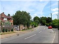
Gander Hill, Haywards Heath
The point where College Road becomes Gander Hill. The road was once part of the old medieval Cuckfield to Lindfield highway that skirted the northern end of the old Haywards Heath common. It left Broad Street, Cuckfield at Hatchgate Lane and followed the route of the bridleway through Paige's Wood then part of Blunt's Wood Crescent and Blunt's Wood Road. Part of the section which crossed the current grounds of Haywards Heath College was removed as public access in the 1950s with a bridleway reappearing heading east from Turners Mill Road between a housing estate and a business park before rejoining Balcombe Road prior to it crossing under the railway. Here the route becomes a highway again along College road then Gander Hill up to Smallsgreen Cross where it would have once crossed Lindfield's West Common and entered that town via Denman's Lane or Hickman's Lane. Much of Gander Hill was developed between the wars.
Image: © Simon Carey
Taken: 18 Jul 2015
0.15 miles