
IMAGES TAKEN NEAR TO
Valentine Drive, BURGESS HILL, RH15 8UE
Introduction
This page details the photographs taken nearby to Valentine Drive, RH15 8UE by members of the Geograph project.
The Geograph project started in 2005 with the aim of publishing, organising and preserving representative images for every square kilometre of Great Britain, Ireland and the Isle of Man.

There are currently over 7.5m images from over14,400 individuals and you can help contribute to the project by visiting https://www.geograph.org.uk
Image Map
Images are licensed for reuse under creativecommons.org/licenses/by-sa/2.0
Notes
- Clicking on the map will re-center to the selected point.
- The higher the marker number, the further away the image location is from the centre of the postcode.
Image Listing (22 Images Found)
Images are licensed for reuse under creativecommons.org/licenses/by-sa/2.0
Image
Details
Distance
1
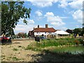
The Woolpack, Burgess Hill
What looks like an old country pub is actually a conversion that took place around the 1990s. Previously it was Westend Farm which dates back to at least 1621 and was probably a rebuild of a much earlier dwelling. The farm was engulfed by the westward expansion of the town during the last decade of the 20th century and was converted along with some of the outbuildings into a pub to serve the new community. The old farm pond can be partially seen in the foreground.
Image: © Simon Carey
Taken: 25 Jul 2014
0.06 miles
3
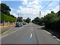
West Street, Burgess Hill
Originally an old track that ran across the Clayton portion of St John's Common which was straightened when it was enclosed in the 1850s. As the town grew the housing gradually expanded westwards reaching the junction with Royal George Road, another highway created by the enclosure of the common, around the 1950s.
Image: © Simon Carey
Taken: 25 Jul 2014
0.09 miles
4
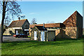
St Edward the Confessor, Burgess Hill
A heavily extended cemetery chapel, now with the status of an Anglican parish church.
Image: © Robin Webster
Taken: 26 Nov 2010
0.10 miles
5

St Edward the Confessor Church, Burgess Hill
Built in 1936 it was extended in 2000 at the same time it became a parish church for the newly built western suburbs of the town.
Image: © Simon Carey
Taken: 25 Jul 2014
0.11 miles
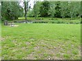
7
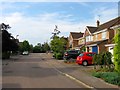
Bayliss Crescent, Burgess Hill
Part of the newly built estates on the western side of Burgess Hill. This road leads off Sussex Way.
Image: © Simon Carey
Taken: 25 Jul 2014
0.12 miles
8
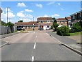
Temple Grove, Burgess Hill
A small cul de sac off Gatehouse Lane built in the 1990s.
Image: © Simon Carey
Taken: 25 Jul 2014
0.15 miles
9
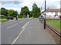
Junction of Weald and Royal George Roads
The footpath entrance to St John's Common is ahead.
Image: © Shazz
Taken: 24 May 2016
0.15 miles
10

Denham Road, Burgess Hill
The section in the foreground was built during the 1930s with the remainder of the road continuing round to Malthouse Lane not added until after the Second World War. The differing styles of the houses in the foreground and those in the distance underline the difference.
Image: © Simon Carey
Taken: 25 Jul 2014
0.17 miles