The Woolpack, Burgess Hill
Introduction
The photograph on this page of The Woolpack, Burgess Hill by Simon Carey as part of the Geograph project.
The Geograph project started in 2005 with the aim of publishing, organising and preserving representative images for every square kilometre of Great Britain, Ireland and the Isle of Man.

There are currently over 7.5m images from over 14,400 individuals and you can help contribute to the project by visiting https://www.geograph.org.uk
The Woolpack, Burgess Hill
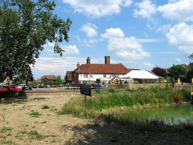
Image: © Simon Carey Taken: 25 Jul 2014
What looks like an old country pub is actually a conversion that took place around the 1990s. Previously it was Westend Farm which dates back to at least 1621 and was probably a rebuild of a much earlier dwelling. The farm was engulfed by the westward expansion of the town during the last decade of the 20th century and was converted along with some of the outbuildings into a pub to serve the new community. The old farm pond can be partially seen in the foreground.
Images are licensed for reuse under creativecommons.org/licenses/by-sa/2.0
Image Location
Latitude
50.962323
Longitude
-0.149351