
IMAGES TAKEN NEAR TO
Northlands Street, BURGESS HILL, RH15 8QU
Introduction
This page details the photographs taken nearby to Northlands Street, RH15 8QU by members of the Geograph project.
The Geograph project started in 2005 with the aim of publishing, organising and preserving representative images for every square kilometre of Great Britain, Ireland and the Isle of Man.

There are currently over 7.5m images from over14,400 individuals and you can help contribute to the project by visiting https://www.geograph.org.uk
Image Map
Images are licensed for reuse under creativecommons.org/licenses/by-sa/2.0
Notes
- Clicking on the map will re-center to the selected point.
- The higher the marker number, the further away the image location is from the centre of the postcode.
Image Listing (50 Images Found)
Images are licensed for reuse under creativecommons.org/licenses/by-sa/2.0
Image
Details
Distance
1
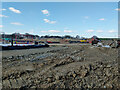
Building site west of Freek's Lane
A large site, but not a lot more than groundworks so far.
Image: © Robin Webster
Taken: 18 Mar 2022
0.06 miles
2
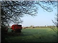
Six Acres/Snuffy Grubby Field
The name of the fields according to Clayton's 1838 tithe map that have been merged to form a larger unit. Six Acres was to the north with a section now part of neighbouring Image whilst Snuffy Grubby Field was to the south. The name of the latter gives some indication of the quality of the field in the 19th century.
Image: © Simon Carey
Taken: 9 Apr 2015
0.07 miles
3
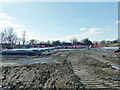
Building site west of Freek's Lane
A large site, but not a lot more than groundworks so far.
Image: © Robin Webster
Taken: 18 Mar 2022
0.08 miles
4
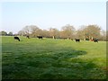
Denchy Mead
The name of the field according to Clayton's 1838 tithe map that lies to the north of Image and south of Image It is bounded to the east by Freek's Lane. Denchy derives from denshire which in turn is a contraction of 'devonshiring', an old method of fertilising poor fields by burning.
Image: © Simon Carey
Taken: 9 Apr 2015
0.09 miles
5
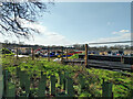
Building site west of Freek's Lane
A large site, but not a lot more than groundworks so far.
Image: © Robin Webster
Taken: 18 Mar 2022
0.09 miles
6
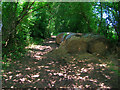
Hay Bales, Freek's Lane
Just to the north of Lowlands Farm where the lane narrows and becomes a footpath.
Image: © Simon Carey
Taken: 8 Jun 2008
0.10 miles
7
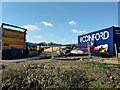
Building site west of Freek's Lane
A large site, but not a lot more than groundworks so far.
Image: © Robin Webster
Taken: 18 Mar 2022
0.10 miles
8
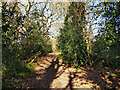
Freek's Lane heading north
It is footpath 96CR.
Image: © Robin Webster
Taken: 18 Mar 2022
0.11 miles
9
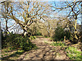
Freek's Lane north of Lowlands Farm
The surface degenerates northwards from here. It is footpath 96CR.
Image: © Robin Webster
Taken: 18 Mar 2022
0.11 miles
10
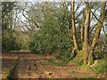
Freek's Lane
The northern end of the lane before it narrows into a footpath. At this point it also briefly follows the course of an old Roman road that linked London to the south coast around modern Brighton.
Image: © Simon Carey
Taken: 9 Apr 2015
0.11 miles