IMAGES TAKEN NEAR TO
Blackhouse Lane, BURGESS HILL, RH15 8BN
Introduction
This page details the photographs taken nearby to Blackhouse Lane, RH15 8BN by members of the Geograph project.
The Geograph project started in 2005 with the aim of publishing, organising and preserving representative images for every square kilometre of Great Britain, Ireland and the Isle of Man.

There are currently over 7.5m images from over14,400 individuals and you can help contribute to the project by visiting https://www.geograph.org.uk
Image Map
Images are licensed for reuse under creativecommons.org/licenses/by-sa/2.0
Notes
- Clicking on the map will re-center to the selected point.
- The higher the marker number, the further away the image location is from the centre of the postcode.
Image Listing (37 Images Found)
Images are licensed for reuse under creativecommons.org/licenses/by-sa/2.0
Image
Details
Distance
1
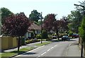
Commuter Land - Noel Rise, Burgess Hill
A residential area of Burgess Hill. The view here is of 1950s houses built close to the main London-Brighton line station at Wivelsfield. There is an area of streets here with a similar style of housing. Burgess Hill is close enough to London to be a dormitory town for London workers.
Image: © Pete Chapman
Taken: 10 Jul 2005
0.08 miles
2
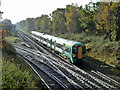
Up train at Keymer Junction
The Eastbourne line diverges sharply to the left. Nowadays a rather odd junction name, as there are bigger places much closer to this point, and the stations each side are Burgess Hill and Wivelsfield - this being very close. Possibly when the line was built the Burgess Hill area was undeveloped, and the most important place locally was Keymer.
Image: © Robin Webster
Taken: 19 Nov 2010
0.12 miles
3
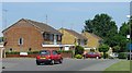
1980s Housing at Leylands Park, Burgess Hill
Burgess Hill has expanded continuously, since the railway first arrived in the nineteenth century. Here we see a typical selection of 1980s built houses built as part of a large estate on the N side of the town.
Image: © Pete Chapman
Taken: 10 Jul 2005
0.16 miles
4
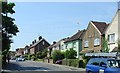
Junction Road, Burgess Hill
A view looking SW along Junction Road. Typical suburban housing, built around the start of the 20th century, and in a convenient catchment area to Wivelsfield Station (approximately a quarter of a mile away) - classic commuter housing.
Image: © Pete Chapman
Taken: 10 Jul 2005
0.17 miles
5
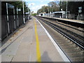
Wivelsfield railway station, West Sussex
Opened in 1854 by the London Brighton & South Coast Railway on the line from Redhill to Brighton. View north towards Haywards Heath and Redhill.
Image: © Nigel Thompson
Taken: 18 Oct 2011
0.19 miles
8
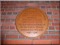
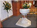
St Andrew, Burgess Hill: memorial (i)
Tindall-Atkinson père was educated at Lincoln College, Oxford and ordained in 1876. He served curacies in Ditchling and Windsor; and incumbencies at Belchamp, Southwick and Zurich before coming here. Tindall-Atkinson fils was educated at Worcester College, Oxford and ordained in 1903 before becoming his father's curate and then his successor.
Image: © Basher Eyre
Taken: 1 Dec 2015
0.20 miles