IMAGES TAKEN NEAR TO
The Conduit, REDHILL, RH1 4QU
Introduction
This page details the photographs taken nearby to The Conduit, RH1 4QU by members of the Geograph project.
The Geograph project started in 2005 with the aim of publishing, organising and preserving representative images for every square kilometre of Great Britain, Ireland and the Isle of Man.

There are currently over 7.5m images from over14,400 individuals and you can help contribute to the project by visiting https://www.geograph.org.uk
Image Map
Images are licensed for reuse under creativecommons.org/licenses/by-sa/2.0
Notes
- Clicking on the map will re-center to the selected point.
- The higher the marker number, the further away the image location is from the centre of the postcode.
Image Listing (25 Images Found)
Images are licensed for reuse under creativecommons.org/licenses/by-sa/2.0
Image
Details
Distance
1
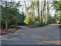
A lane crossways
All of these lanes have only bridleway status for the public, so it is odd that the sign referring to bridleway 147 (to the left) points out that only authorized vehicles are allowed, when the same remark should apply to all of the routes. Bridleway 147 is called The Conduit, which continues to the right behind the viewpoint as Hextalls Lane. Bridleway 541 to the right is also Hextalls Lane, and 541 continues to the left behind the viewpoint as Roughets Lane.
Image: © Robin Webster
Taken: 21 Jan 2011
0.09 miles
4
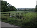
A field with some horses
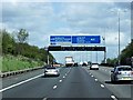
This picture sums up this square neatly. The northern third of the square contains some very large houses, interspersed with some paddocks with horses. Then, the square is sliced neatly by the M25. Beyond that are some trees before the ground turns into the desolate wastes of a sand pit. The sand pit is relatively new and isn't reflected on Ordnance Survey maps - much of the south of the square has completely changed - a lane entitled Green Lane Track is no longer there neither it seems is the copse entitled Big Pickle.
Image: © Hywel Williams
Taken: 29 Sep 2005
0.10 miles
6
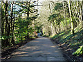
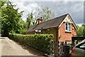
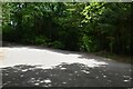
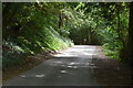
Hextalls Lane
Only a bridleway for the public, but there are several properties down here using this lane for vehicular access.
Image: © Robin Webster
Taken: 21 Jan 2011
0.13 miles