
IMAGES TAKEN NEAR TO
Brighton Road, HORSHAM, RH13 6NQ
Introduction
This page details the photographs taken nearby to Brighton Road, RH13 6NQ by members of the Geograph project.
The Geograph project started in 2005 with the aim of publishing, organising and preserving representative images for every square kilometre of Great Britain, Ireland and the Isle of Man.

There are currently over 7.5m images from over14,400 individuals and you can help contribute to the project by visiting https://www.geograph.org.uk
Image Map
Images are licensed for reuse under creativecommons.org/licenses/by-sa/2.0
Notes
- Clicking on the map will re-center to the selected point.
- The higher the marker number, the further away the image location is from the centre of the postcode.
Image Listing (18 Images Found)
Images are licensed for reuse under creativecommons.org/licenses/by-sa/2.0
Image
Details
Distance
1
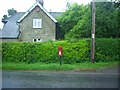
Post Box
Post Box RH12 116 Beedinglee
Image: © The Saunterer
Taken: 10 Jun 2012
0.01 miles
2
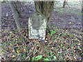
Milestone by the A281
Mileage is Brighton 18 miles, Horsham 4 miles.
Image: © Dave Spicer
Taken: 13 Mar 2011
0.05 miles
3
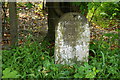
Milestone Near Lower Beeding, Sussex
Seen on the A281, near Leonardslee Gardens. In 2010, it is not very informative, as it is difficult to make out the distances, to Brighton and Horsham, even at close range!
Image: © Peter Trimming
Taken: 5 Jun 2010
0.07 miles
4
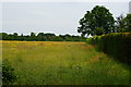
Field Near Lower Beeding, Sussex
Left fallow in 2010. Houses have been built to the right of the hedge, but they look to be well established. This area would previously have been part of the field.
Image: © Peter Trimming
Taken: 5 Jun 2010
0.07 miles
5
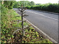
Wire tree beside the A281 in Lower Beeding
Image: © Gareth James
Taken: 11 Jun 2011
0.12 miles
6
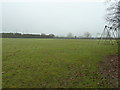
Recreation field at Lower Beeding
Situated by Lower Beeding village hall.
Image: © Dave Spicer
Taken: 13 Mar 2011
0.15 miles
7
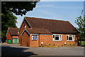
Beedinglee Village Hall, Sussex
Photographed from the B2110.
Image: © Peter Trimming
Taken: 5 Jun 2010
0.17 miles
9
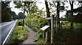
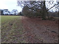
Start of the Sussex Ouse Valley Way
Alongside the B2110 at Lower Beeding (West Sussex). It's 42 miles from here to the end of the walk at Seaford (East Sussex).
Although the Sussex Ouse Valley Way lies inside the valley of the River Ouse it is not confined to the riverbank. This is because, for the most-part, there is no public right of way of any form that runs alongside the river.
Image: © Manchester Warrior
Taken: 31 May 2008
0.20 miles
10
Looking along the A281 from footpath junction
Image: © Shazz
Taken: 7 Dec 2016
0.20 miles