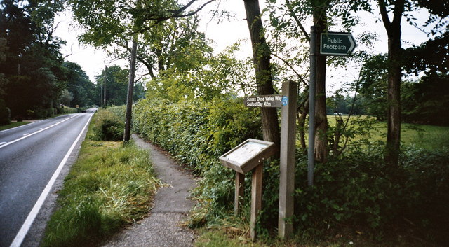
Start of the Sussex Ouse Valley Way
Introduction
The photograph on this page of Start of the Sussex Ouse Valley Way by Manchester Warrior as part of the Geograph project.
The Geograph project started in 2005 with the aim of publishing, organising and preserving representative images for every square kilometre of Great Britain, Ireland and the Isle of Man.
There are currently over 7.5m images from over 14,400 individuals and you can help contribute to the project by visiting https://www.geograph.org.uk

Image: © Manchester Warrior Taken: 31 May 2008
Alongside the B2110 at Lower Beeding (West Sussex). It's 42 miles from here to the end of the walk at Seaford (East Sussex). Although the Sussex Ouse Valley Way lies inside the valley of the River Ouse it is not confined to the riverbank. This is because, for the most-part, there is no public right of way of any form that runs alongside the river.

