1
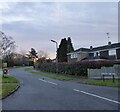
Forest Close, Mannings Heath
A cul de sac off Limekiln Road that was built in the 1970s.
Image: © Simon Carey
Taken: 26 Dec 2023
0.02 miles
2
Seat on grassy area in Mannings Heath
Image: © Shazz
Taken: 27 Apr 2016
0.06 miles
3
Woodlands Walk, Mannings Heath
A residential road off Church Road developed during the 1970s.
Image: © Simon Carey
Taken: 26 Dec 2023
0.06 miles
4
Limekiln Road, Mannings Heath
A residential road that was developed in the 1970s.
Image: © Simon Carey
Taken: 26 Dec 2023
0.06 miles
5
1-4, North Cottages, Church Road, Mannings Heath
A small terrace of cottages built in the first decade of the 20th century.
Image: © Simon Carey
Taken: 26 Dec 2023
0.07 miles
6
Cleavers, Church Road, Mannings Heath
The brickwork on the right suggests an extension sometime in the past.
Image: © Simon Carey
Taken: 26 Dec 2023
0.07 miles
7
Church Road, Mannings Heath
The semi-detached dwellings on the left are, from left to right: Dunston Cottages, Crofton Corrages and Craven Cottages, all built in 1913.
Image: © Simon Carey
Taken: 26 Dec 2023
0.07 miles
8
The Village Store, Mannings Heath, West Sussex
The shop, situated in the centre of this small village, opposite a small green.
Image: © Pete Chapman
Taken: 30 Nov 2005
0.07 miles
9
Signpost at western end of Winterpit Lane
A different view is at http://www.geograph.org.uk/photo/1864181.
Image: © Shazz
Taken: 27 Apr 2016
0.09 miles
10
Church of the Good Shepherd, Mannings Heath
Built as chapel in 1881 to serve the newly expanding hamlet of Mannings Heath which is located within the parish of Nuthurst. Still in use today, though more as a community centre than a place of worship.
Image: © Simon Carey
Taken: 26 Dec 2023
0.09 miles


