
IMAGES TAKEN NEAR TO
Ryecroft Meadow, HORSHAM, RH13 6JN
Introduction
This page details the photographs taken nearby to Ryecroft Meadow, RH13 6JN by members of the Geograph project.
The Geograph project started in 2005 with the aim of publishing, organising and preserving representative images for every square kilometre of Great Britain, Ireland and the Isle of Man.

There are currently over 7.5m images from over14,400 individuals and you can help contribute to the project by visiting https://www.geograph.org.uk
Image Map
Images are licensed for reuse under creativecommons.org/licenses/by-sa/2.0
Notes
- Clicking on the map will re-center to the selected point.
- The higher the marker number, the further away the image location is from the centre of the postcode.
Image Listing (82 Images Found)
Images are licensed for reuse under creativecommons.org/licenses/by-sa/2.0
Image
Details
Distance
1
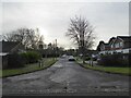
Ryecroft Meadow, Mannings Heath
A cul de sac off Pound Lane built in the 1970s. in the grounds of a former Victoriasn house called Ryecroft.
Image: © Simon Carey
Taken: 26 Dec 2023
0.01 miles
2
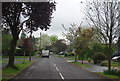
Looking along Ryecroft Meadow
An estate road.
Image: © N Chadwick
Taken: 2 May 2010
0.04 miles
3
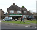
The Village Store, Mannings Heath, West Sussex
The shop, situated in the centre of this small village, opposite a small green.
Image: © Pete Chapman
Taken: 30 Nov 2005
0.05 miles
4
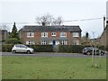
Cleavers, Church Road, Mannings Heath
The brickwork on the right suggests an extension sometime in the past.
Image: © Simon Carey
Taken: 26 Dec 2023
0.05 miles
5
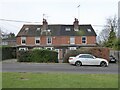
1-4, North Cottages, Church Road, Mannings Heath
A small terrace of cottages built in the first decade of the 20th century.
Image: © Simon Carey
Taken: 26 Dec 2023
0.05 miles
6
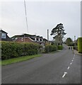
Pound Lane, Mannings Heath
One of the old roads the village was built around. Mannings Heath was a former common and the pound was a structure where stray animals were kept awaiting pick up from their owner.
Image: © Simon Carey
Taken: 26 Dec 2023
0.06 miles
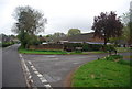
8
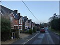
Church Road, Mannings Heath
The semi-detached dwellings on the left are, from left to right: Dunston Cottages, Crofton Corrages and Craven Cottages, all built in 1913.
Image: © Simon Carey
Taken: 26 Dec 2023
0.06 miles
10
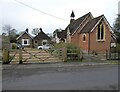
Church of the Good Shepherd, Mannings Heath
Built as chapel in 1881 to serve the newly expanding hamlet of Mannings Heath which is located within the parish of Nuthurst. Still in use today, though more as a community centre than a place of worship.
Image: © Simon Carey
Taken: 26 Dec 2023
0.07 miles