IMAGES TAKEN NEAR TO
Mill Lane, CRAWLEY, RH10 3HW
Introduction
This page details the photographs taken nearby to Mill Lane, RH10 3HW by members of the Geograph project.
The Geograph project started in 2005 with the aim of publishing, organising and preserving representative images for every square kilometre of Great Britain, Ireland and the Isle of Man.

There are currently over 7.5m images from over14,400 individuals and you can help contribute to the project by visiting https://www.geograph.org.uk
Image Map
Images are licensed for reuse under creativecommons.org/licenses/by-sa/2.0
Notes
- Clicking on the map will re-center to the selected point.
- The higher the marker number, the further away the image location is from the centre of the postcode.
Image Listing (44 Images Found)
Images are licensed for reuse under creativecommons.org/licenses/by-sa/2.0
Image
Details
Distance
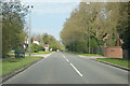
1
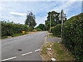
Mill Lane, Copthorne
Towards the B2028 Turner's Hill Road. The West Sussex - Surrey boundary seems to run down the middle of the road, Surrey on the left.
Image: © Robin Webster
Taken: 13 Jul 2022
0.05 miles
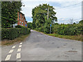
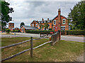
2
B2028 at Effingham Park
West Park Road passes an old entrance into the hotel ground, followed by the junction with Chapel Lane and Mill Lane.
Image: © Derek Harper
Taken: 3 Aug 2018
0.11 miles
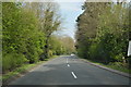
4
Effingham Lane
In Surrey, in the foreground is a right-angled bend with Mill Lane, half in Surrey, half in West Sussex.
Image: © Robin Webster
Taken: 13 Jul 2022
0.11 miles
5
Public footpath 17W, Copthorne Upper Common
From Copthorne Common Road to Mill Lane.
Image: © Robin Webster
Taken: 13 Jul 2022
0.11 miles
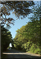
8
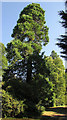
Pine, Effingham Park
On an old drive at the south edge of the hotel grounds.
Image: © Derek Harper
Taken: 3 Aug 2018
0.12 miles
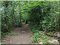
9
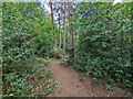
Public footpath 16W, Copthorne Upper Common
This ought to run straight from corner to corner of the wooded rectangular common, but many other paths complicate matters. The common is owned by Copthorne Preparatory School, who seem to use it for educational and recreational purposes. General public access is tolerated.
Image: © Robin Webster
Taken: 13 Jul 2022
0.13 miles
10
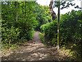
Public footpath 17W, Copthorne Upper Common
From Copthorne Common Road to Mill Lane.
Image: © Robin Webster
Taken: 13 Jul 2022
0.13 miles