IMAGES TAKEN NEAR TO
Inkpen Common, HUNGERFORD, RG17 9QW
Introduction
This page details the photographs taken nearby to Inkpen Common, RG17 9QW by members of the Geograph project.
The Geograph project started in 2005 with the aim of publishing, organising and preserving representative images for every square kilometre of Great Britain, Ireland and the Isle of Man.

There are currently over 7.5m images from over14,400 individuals and you can help contribute to the project by visiting https://www.geograph.org.uk
Image Map
Images are licensed for reuse under creativecommons.org/licenses/by-sa/2.0
Notes
- Clicking on the map will re-center to the selected point.
- The higher the marker number, the further away the image location is from the centre of the postcode.
Image Listing (22 Images Found)
Images are licensed for reuse under creativecommons.org/licenses/by-sa/2.0
Image
Details
Distance
1
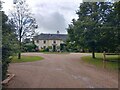
Trappshill House
Trappshill (or perhaps Trapshill) House near to Trapshill.
Image: © Oscar Taylor
Taken: 11 Jul 2023
0.00 miles
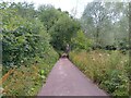
2
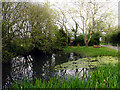
Village Pond: Upper Green
This pond is situated on the western edge of the grid square.
Image: © Pam Brophy
Taken: 29 Apr 2005
0.12 miles
3
Inkpen Village
The Crown and Garter pub, situated in the north eastern section of the grid square, is north east of the pond at Upper Green. This picture was taken from the footpath.
Image: © Pam Brophy
Taken: 29 Apr 2005
0.12 miles
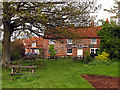
5
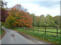
Autumn colour near Kirby House
There is still a lot of green about, but this tree is in the van of seasonal change.
Image: © Robin Webster
Taken: 25 Oct 2014
0.13 miles
6
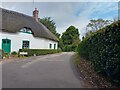
Trapshill
A road called Trapshill in Trapshill, looking past White Cottage.
Image: © Oscar Taylor
Taken: 11 Jul 2023
0.16 miles
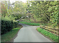
7
Minor Road, near Kirby House, Trapshill
Looking back towards Inkpen, from Kirby House.
Image: © Wayland Smith
Taken: 4 May 2014
0.17 miles
8
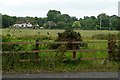
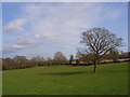
Near Trapshill
Paddock land and small field farmland in the lee of the Hampshire Downs.
Image: © Graham Horn
Taken: 26 Jul 2009
0.17 miles
9
Restricted byway towards Prosser's Farm
A restricted byway leading to Prosser's Farm.
Image: © Oscar Taylor
Taken: 11 Jul 2023
0.19 miles
10
Pasture, Inkpen
A view from the footpath east of Rolf's Farm.
Image: © Andrew Smith
Taken: 22 Mar 2009
0.19 miles