IMAGES TAKEN NEAR TO
Roby Avenue, CHORLEY, PR7 7DR
Introduction
This page details the photographs taken nearby to Roby Avenue, PR7 7DR by members of the Geograph project.
The Geograph project started in 2005 with the aim of publishing, organising and preserving representative images for every square kilometre of Great Britain, Ireland and the Isle of Man.

There are currently over 7.5m images from over14,400 individuals and you can help contribute to the project by visiting https://www.geograph.org.uk
Image Map
Images are licensed for reuse under creativecommons.org/licenses/by-sa/2.0
Notes
- Clicking on the map will re-center to the selected point.
- The higher the marker number, the further away the image location is from the centre of the postcode.
Image Listing (25 Images Found)
Images are licensed for reuse under creativecommons.org/licenses/by-sa/2.0
Image
Details
Distance
1
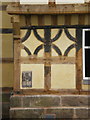
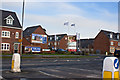
New housing in Buckshaw Village
It is housing even though it looks like a warehouse
Image: © Alexander P Kapp
Taken: 17 Apr 2007
0.04 miles
2
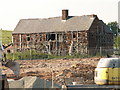
Old Worden Hall
Old Worden Hall is another historic building which has been hidden for many years within the grounds of the Royal Ordnance site. Now that the site has largely closed and the land is being redeveloped for housing, it is possible to once again see this Hall. Whether it will be renovated or demolished remains to be seen - it certainly can't stay as it is once the houses are built!
Image: © Martin Stockdale
Taken: 7 Jun 2005
0.06 miles
3
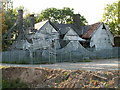
Buckshaw Hall
Buckshaw Hall appears in both the 1940 and the current OS map, but neither map shows the history of the area. From the 1940's until very recently, this whole area was a Royal Ordnance weapons factory. The factory has now largely closed, and the land is being redeveloped into a large housing estate. Buckshaw Hall is one of three halls within the area which have been hidden from view and largely untouched for many years. The presence of scaffolding and plastic covers suggest that restoration work is planned.
Image: © Martin Stockdale
Taken: 7 Jun 2005
0.06 miles
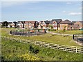
5
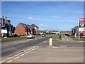
Whittle-Le-Park, Buckshaw Lane
New housing estate, Buckshaw Village.
Image: © David Dixon
Taken: 11 Jun 2014
0.15 miles
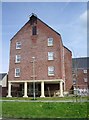
8
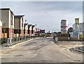
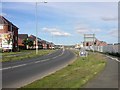
New Housing Development, Ordnance Road
New homes under construction on the site of the former Royal Ordnance factory, Buckshaw.
Image: © David Dixon
Taken: 11 Jun 2014
0.20 miles
9
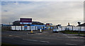
New Housing on the site of the Former Royal Ordnance Factory, Buckshaw
Image: © David Dixon
Taken: 11 Jun 2014
0.21 miles