Buckshaw Hall
Introduction
The photograph on this page of Buckshaw Hall by Martin Stockdale as part of the Geograph project.
The Geograph project started in 2005 with the aim of publishing, organising and preserving representative images for every square kilometre of Great Britain, Ireland and the Isle of Man.

There are currently over 7.5m images from over 14,400 individuals and you can help contribute to the project by visiting https://www.geograph.org.uk
Buckshaw Hall
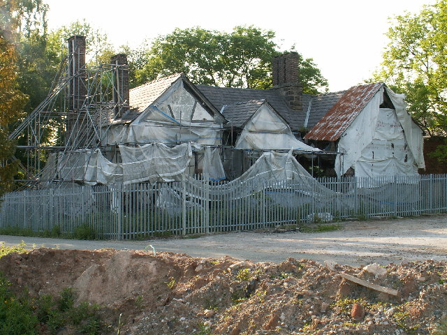
Image: © Martin Stockdale Taken: 7 Jun 2005
Buckshaw Hall appears in both the 1940 and the current OS map, but neither map shows the history of the area. From the 1940's until very recently, this whole area was a Royal Ordnance weapons factory. The factory has now largely closed, and the land is being redeveloped into a large housing estate. Buckshaw Hall is one of three halls within the area which have been hidden from view and largely untouched for many years. The presence of scaffolding and plastic covers suggest that restoration work is planned.
Images are licensed for reuse under creativecommons.org/licenses/by-sa/2.0
Image Location
Latitude
53.679141
Longitude
-2.660027