IMAGES TAKEN NEAR TO
Greenwood, PRESTON, PR5 8JX
Introduction
This page details the photographs taken nearby to Greenwood, PR5 8JX by members of the Geograph project.
The Geograph project started in 2005 with the aim of publishing, organising and preserving representative images for every square kilometre of Great Britain, Ireland and the Isle of Man.

There are currently over 7.5m images from over14,400 individuals and you can help contribute to the project by visiting https://www.geograph.org.uk
Image Map
Images are licensed for reuse under creativecommons.org/licenses/by-sa/2.0
Notes
- Clicking on the map will re-center to the selected point.
- The higher the marker number, the further away the image location is from the centre of the postcode.
Image Listing (11 Images Found)
Images are licensed for reuse under creativecommons.org/licenses/by-sa/2.0
Image
Details
Distance
1
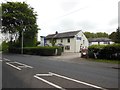
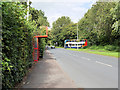
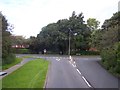
Clayton Brook Road
At its junction with Preston Road (A6).
Image: © philandju
Taken: 10 Jun 2022
0.07 miles
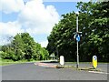
3
Traffic Calming Chicane on Clayton Brook Road
Image: © David Dixon
Taken: 9 Sep 2020
0.17 miles
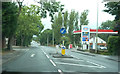
5
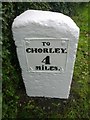
Old Milestone by the A6, Preston Road, Clayton-le-Woods Parish
Metal plate attached to stone post by the A6, in parish of Clayton-Le-Woods (Chorley District), Preston Road, by No. 614, 50m N of Forsythia Drive; just North of new housing (Woodside Park), in grass between path and domestic hedge, on East side of road. Preston wedge, erected by the Wigan & Preston (north of Yarrow) turnpike trust in the 19th century.
Inscription reads:-
TO / CHORLEY / 4 / MILES : : TO / PRESTON / 5 / MILES
Carved benchmark on lower front edge.
Grade II listed. List Entry Number: 1072446
https://historicengland.org.uk/listing/the-list/list-entry/1072446
Milestone Society National ID: LA_CYPS04
Image: © Bishop Michael
Taken: Unknown
0.21 miles
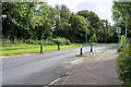
6
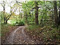
Hawksclough
The bridleway and footpath from Clayton Brook to Clayton Green leaves the A6, passing Clayton Cottages and then descending through Hawksclough. The houses at Hawksclough can just be seen through the trees.
Image: © Roger May
Taken: 10 Nov 2005
0.23 miles
7
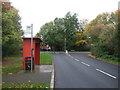
Bus stop and shelter on Great Greens Lane, Clayton Brook
Looking north west.
Image: © JThomas
Taken: 25 Oct 2018
0.24 miles
8
Clayton Brook Housing Estate
Great Greens Lane joins Clayton Brook Road
Image: © Raymond Knapman
Taken: 2 Aug 2012
0.24 miles
9
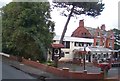
The Pines restaurant on Preston Road at Clayton le Woods
Image: © Raymond Knapman
Taken: 2 Aug 2012
0.25 miles