Old Milestone by the A6, Preston Road, Clayton-le-Woods Parish
Introduction
The photograph on this page of Old Milestone by the A6, Preston Road, Clayton-le-Woods Parish by Bishop Michael as part of the Geograph project.
The Geograph project started in 2005 with the aim of publishing, organising and preserving representative images for every square kilometre of Great Britain, Ireland and the Isle of Man.

There are currently over 7.5m images from over 14,400 individuals and you can help contribute to the project by visiting https://www.geograph.org.uk
Old Milestone by the A6, Preston Road, Clayton-le-Woods Parish
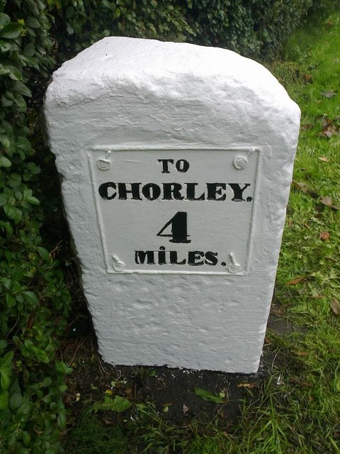
Image: © Bishop Michael Taken: Unknown
Metal plate attached to stone post by the A6, in parish of Clayton-Le-Woods (Chorley District), Preston Road, by No. 614, 50m N of Forsythia Drive; just North of new housing (Woodside Park), in grass between path and domestic hedge, on East side of road. Preston wedge, erected by the Wigan & Preston (north of Yarrow) turnpike trust in the 19th century. Inscription reads:- TO / CHORLEY / 4 / MILES : : TO / PRESTON / 5 / MILES Carved benchmark on lower front edge. Grade II listed. List Entry Number: 1072446 https://historicengland.org.uk/listing/the-list/list-entry/1072446 Milestone Society National ID: LA_CYPS04
Images are licensed for reuse under creativecommons.org/licenses/by-sa/2.0
Image Location
Latitude
53.709132
Longitude
-2.640772