IMAGES TAKEN NEAR TO
Lyndale Grove, PRESTON, PR5 5XX
Introduction
This page details the photographs taken nearby to Lyndale Grove, PR5 5XX by members of the Geograph project.
The Geograph project started in 2005 with the aim of publishing, organising and preserving representative images for every square kilometre of Great Britain, Ireland and the Isle of Man.

There are currently over 7.5m images from over14,400 individuals and you can help contribute to the project by visiting https://www.geograph.org.uk
Image Map
Images are licensed for reuse under creativecommons.org/licenses/by-sa/2.0
Notes
- Clicking on the map will re-center to the selected point.
- The higher the marker number, the further away the image location is from the centre of the postcode.
Image Listing (9 Images Found)
Images are licensed for reuse under creativecommons.org/licenses/by-sa/2.0
Image
Details
Distance
1
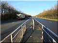
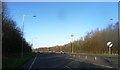
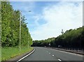
Looking north along the A6 London Way from a foot crossing
Looking north along the A6 towards Preston.
This photo was taken from the middle of three foot crossings of this dual carriageway in a very short distance. The next one can be seen approximately 100m further up the road. Whilst all are open to the public, only that next crossing is a recorded public footpath. However, the council have erroneously placed the public footpath signs on this middle crossing instead.
Image: © Adam C Snape
Taken: 27 Dec 2015
0.09 miles
2
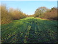
Green space near A6
When the bypass (A6) was built, some of the land either side was retained as public green space and trees were planted. With their proximity to housing, these areas are quite well used by the public for dog walking and the like. It falls within the area of the proposed South Ribble Central Park https://web.archive.org/web/20151005072030/http://www.southribble.gov.uk/sites/default/files/CentralparkMasterplan.pdf .
Image: © Adam C Snape
Taken: 27 Dec 2015
0.14 miles
3

Pond on the site of the former Preston Junction
An attractive pond has formed in Preston Junction Nature Reserve on the site of the old railway junction, just south of Todd Lane and the former station.
The junction was at a point around the far end of the pond. The line to Bamber Bridge passed to the right of the pond. It is maintained as far as Brownedge Road as a shared use foot and cycle path (Route 55 of the National Cycle Network) which can be seen in the photo. This photo is taken from the position of the former line to Lostock Hall which may still be walked as far as Red Bridge on Brownedge Road.
A photo of the pond taken from an alternate angle can be seen here: Image
Image: © Adam C Snape
Taken: 27 Dec 2015
0.17 miles
4
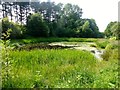
Pond Beside Cycle Route
Pond close to National Cycle Route 55 which looked rather pretty in today's sunshine.
Image: © Rude Health
Taken: 5 Jul 2013
0.19 miles
5

Turf zone KensingtnPond
Pond to the west of London Way near Bamber Bridge.
Image: © Ian S
Taken: 28 May 2023
0.19 miles
7
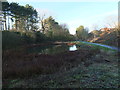
Site of the former Preston Junction
An attractive pond has formed in Preston Junction Nature Reserve on the site of the old railway junction, just south of Todd Lane and the former station.
The junction was at a point around the far end of the pond. The line to Bamber Bridge passed to the right. Its route is maintained as far as Brownedge Road as a shared use foot and cycle path (Route 55 of the National Cycle Network) which can be seen in the photo. The line to Lostock Hall passed to the left and may still be walked as far as Red Bridge on Brownedge Road.
A photo of the pond from a similar angle taken in summer can be seen here: Image
A photo of the pond taken from an alternative angle, looking from the former Lostock Hall branch of the junction can be seen here: Image
Image: © Adam C Snape
Taken: 27 Dec 2015
0.22 miles
8
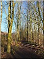
A woodland walk
Created as part of the development of the Walton Park housing estate, this is a nice woodland walk from the pond to Old Tram Road. It falls within the area of the proposed South Ribble Central Park https://web.archive.org/web/20151005072030/http://www.southribble.gov.uk/sites/default/files/CentralparkMasterplan.pdf (pdf).
Image: © Adam C Snape
Taken: 27 Dec 2015
0.22 miles