Site of the former Preston Junction
Introduction
The photograph on this page of Site of the former Preston Junction by Adam C Snape as part of the Geograph project.
The Geograph project started in 2005 with the aim of publishing, organising and preserving representative images for every square kilometre of Great Britain, Ireland and the Isle of Man.

There are currently over 7.5m images from over 14,400 individuals and you can help contribute to the project by visiting https://www.geograph.org.uk
Site of the former Preston Junction
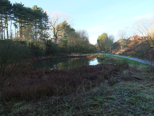
Image: © Adam C Snape Taken: 27 Dec 2015
An attractive pond has formed in Preston Junction Nature Reserve on the site of the old railway junction, just south of Todd Lane and the former station. The junction was at a point around the far end of the pond. The line to Bamber Bridge passed to the right. Its route is maintained as far as Brownedge Road as a shared use foot and cycle path (Route 55 of the National Cycle Network) which can be seen in the photo. The line to Lostock Hall passed to the left and may still be walked as far as Red Bridge on Brownedge Road. A photo of the pond from a similar angle taken in summer can be seen here: Image A photo of the pond taken from an alternative angle, looking from the former Lostock Hall branch of the junction can be seen here: Image
Images are licensed for reuse under creativecommons.org/licenses/by-sa/2.0
Image Location
Latitude
53.730268
Longitude
-2.679018