IMAGES TAKEN NEAR TO
Kingsway, PLYMOUTH, PL7 5AW
Introduction
This page details the photographs taken nearby to Kingsway, PL7 5AW by members of the Geograph project.
The Geograph project started in 2005 with the aim of publishing, organising and preserving representative images for every square kilometre of Great Britain, Ireland and the Isle of Man.

There are currently over 7.5m images from over14,400 individuals and you can help contribute to the project by visiting https://www.geograph.org.uk
Image Map (Loading...)


Getting Data...Please wait
Leaflet Map data © OpenStreetMap
Images are licensed for reuse under creativecommons.org/licenses/by-sa/2.0
Notes
- Clicking on the map will re-center to the selected point.
- The higher the marker number, the further away the image location is from the centre of the postcode.
Image Listing (11 Images Found)
Images are licensed for reuse under creativecommons.org/licenses/by-sa/2.0
Image
Details
Distance
1
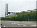
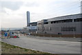
Langage power station
A gas-fired power station Image
Image: © David Smith
Taken: 28 May 2016
0.10 miles
2
Power station
This Power station at Langage,on the outskirts of Plympton,is running twelve months behind schedule.
Image: © jeff collins
Taken: 1 Mar 2009
0.15 miles
3
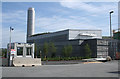
Sparkwell: Langage Energy Centre
A new £400 million gas-fired power station nearing completion in July 2009. The rationale for this site is that there is little existing generating capacity now in the south west: this energy centre will make the National Grid more efficient by reducing energy losses through transmission from up-country power plants. A new gas pipeline has had to be laid in. The centre will also provide work for 50 people
Image: © Martin Bodman
Taken: 15 Jul 2009
0.16 miles
4
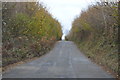
Closed road to Langage Farm
Langage Farm is now the construction site of a gas-fired power station and the road to the farm has been closed to traffic. The farm buildings now house the site offices.
Image: © Nigel Mole
Taken: 23 Nov 2007
0.17 miles
5
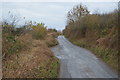
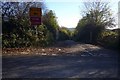
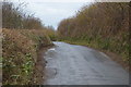
This used to be a road junction!
The road was blocked when the Langage Solar Farm was built behind the hedge.
Image: © N Chadwick
Taken: 3 Dec 2016
0.19 miles
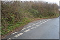
7
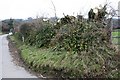
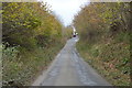
Taming the Hedge
This hedgerow at Langage Cross had been allowed to grow out into small trees.
Image: © Tony Atkin
Taken: 11 Feb 2006
0.21 miles