Sparkwell: Langage Energy Centre
Introduction
The photograph on this page of Sparkwell: Langage Energy Centre by Martin Bodman as part of the Geograph project.
The Geograph project started in 2005 with the aim of publishing, organising and preserving representative images for every square kilometre of Great Britain, Ireland and the Isle of Man.

There are currently over 7.5m images from over 14,400 individuals and you can help contribute to the project by visiting https://www.geograph.org.uk
Sparkwell: Langage Energy Centre
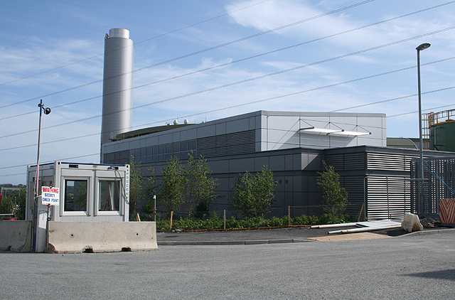
Image: © Martin Bodman Taken: 15 Jul 2009
A new £400 million gas-fired power station nearing completion in July 2009. The rationale for this site is that there is little existing generating capacity now in the south west: this energy centre will make the National Grid more efficient by reducing energy losses through transmission from up-country power plants. A new gas pipeline has had to be laid in. The centre will also provide work for 50 people
Images are licensed for reuse under creativecommons.org/licenses/by-sa/2.0
Image Location


Leaflet Map data © OpenStreetMap
Latitude
50.389174
Longitude
-4.011587