1
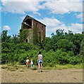
New Consols Mine in 1984
https://historicengland.org.uk/listing/the-list/list-entry/1409595?section=official-listing
Image: © Sandy Gerrard
Taken: Unknown
0.16 miles
2
Wheal Martha or New Great Consols, Luckett
One of the engine houses on this mine, taken in 1977. This was the 28 inch crusher. The mine was noted for its complicated ores, making separation difficult. These included copper, arsenic, silver, wolfram, tin and pyrite. For many years the main pumping engine remained in its house, rusting away. These days the excessive ivy growth has more or less completely enveloped this house.
Image: © Richard Bird
Taken: 12 Aug 1977
0.16 miles
3
Old Direction Sign - Signpost by Broadgate, Stoke Climsland Parish
Raised finial - G type; by the UC road, in parish of Stoke Climsland (Caradon District), East of Luckett, on bank.
Cornwall & Scilly HER listed.
HER Number: MCO57731 https://www.heritagegateway.org.uk/Gateway/Results_Single.aspx?uid=MCO57731&resourceID=1020
Surveyed
Milestone Society National ID: CW_SX3873
Image: © Milestone Society
Taken: Unknown
0.18 miles
4
Luckett Post Office
Image: © Tony Atkin
Taken: 19 May 2007
0.21 miles
5
Luckett
From this bridge, Luckett village follows a steep road up the hillside. Luckett was a 19th century mining village.
Image: © Tony Atkin
Taken: 19 May 2007
0.23 miles
6
Tree and barn, Luckett
The barn is on the edge of both the village and the area of the Cornwall and West Devon Mining Landscape; the New Consols Mine mus have dominated the village in the C19 and early C20.
Image: © Derek Harper
Taken: 4 Mar 2015
0.23 miles
7
Luckett village, Cornwall
Luckett village, Cornwall
Image: © Kevin Hale
Taken: 1 Jun 2006
0.24 miles
8
The stream at Broadgate
Running through Jopes Plantation.
Image: © Rod Allday
Taken: 22 May 2011
0.24 miles
9
Luckett
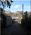
The village street, with Luckett Bridge http://list.historicengland.org.uk/resultsingle.aspx?uid=1220500&searchtype=mapsearch visible just before the row of cottages facing the camera. The whole village forms a conservation area, more than half of which is occupied by the former New Consols Mine, its workings and buildings associated with it.
Image: © Derek Harper
Taken: 4 Mar 2015
0.25 miles


